The Forrest Biome
Wildland AZ Writings
I write because the salience of memory bleeds unless moved from tongue to script. This site serves as a reservoir for my thoughts and experiences.
Published Bikepacking Routes

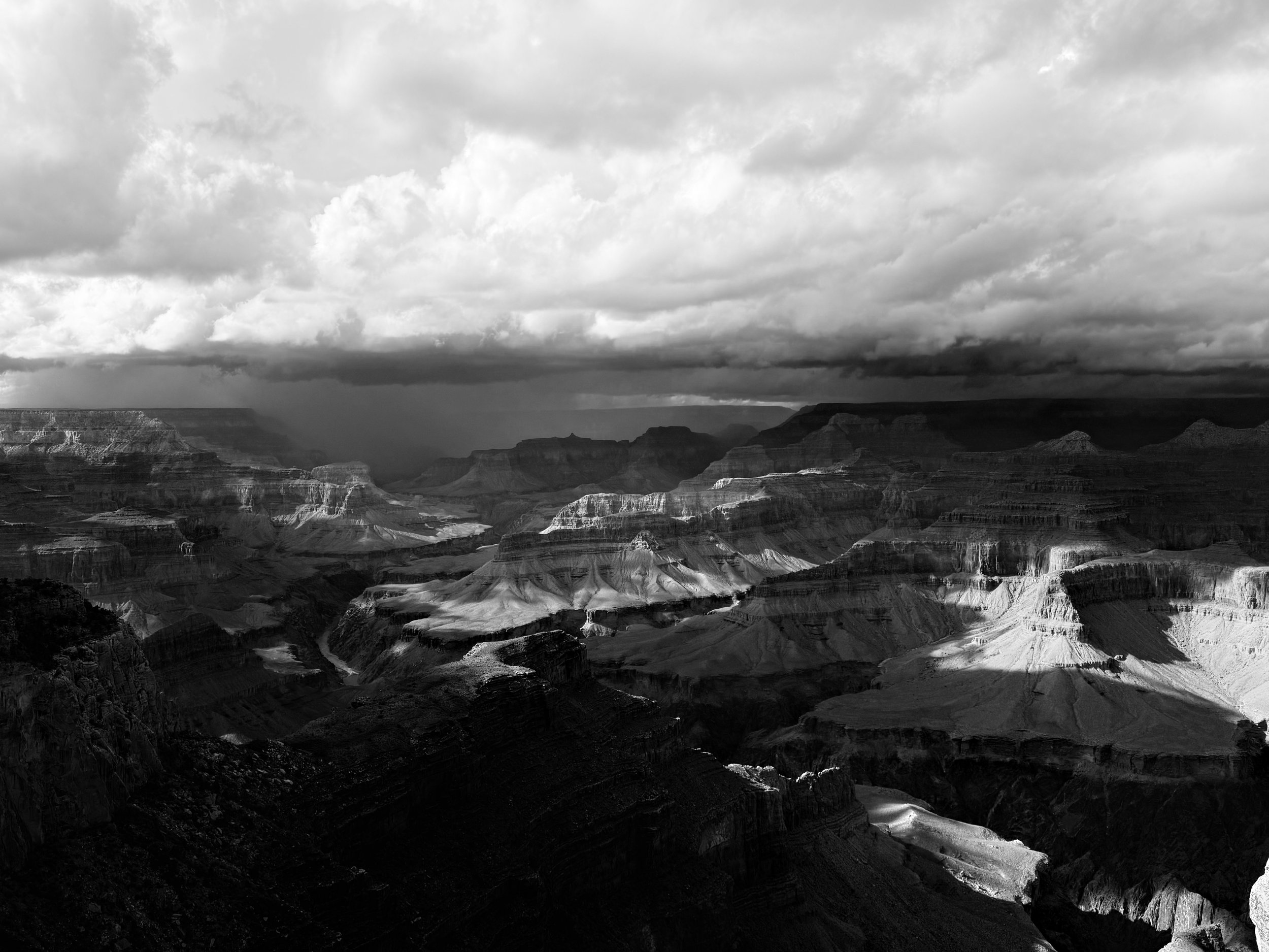
The Capes of the Canyon are a set of two bikepacking routes located on the South and North Rims of Grand Canyon National Park. Both routes traverse classic Colorado Plateau geography. The COTC take riders into vast forests of pinyon, juniper, ponderosa, aspen, and spruce. They travel through open subalpine meadows and arid savannahs. They cross exposed plains of sand, sage, stone, and prickly pear. They traverse across benchlands and canyonlands topography. They peer down at the waters of the Colorado River. And most strikingly, they take bikepackers to Capes of land jutting out into geological space, providing riders iconically recognizable and rarely regarded views of the Grand Canyon.

House Rock Wrap takes bikepackers on a wraparound traverse across House Rock Valley to viewpoints of Marble Canyon. Riders can expect to visit and camp rim-side at Pronghorn, Bedrock, South Canyon, Buck Farm, and Triple Alcove points. These overlooks provide expansive views of the Colorado River as it courses through the redwall layers of Marble Canyon - a precursor to the Grand Canyon. The route is framed by the sheer rising walls of Vermilion Cliffs National Monument to the north, the iconic Saddle Mountain Wilderness to the south, the gorge of Marble Canyon to the east, and the ascending flanks of the Kaibab Plateau to the west. House Rock Valley provides a multitude of dirt roads crossing high desert grasslands where pronghorn, deer, and bison frequent.

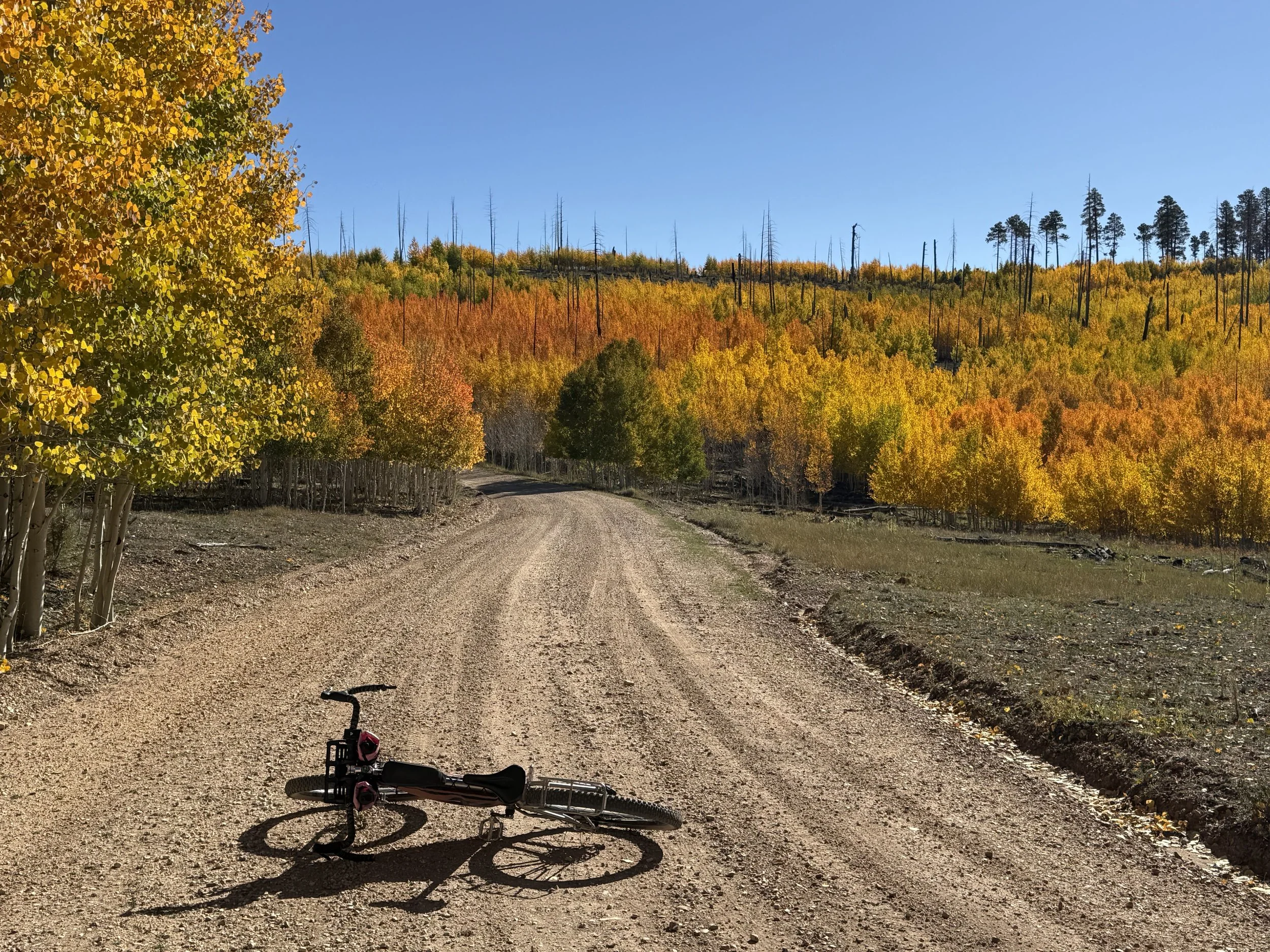
El Lobo Lupus takes bikepackers through the high elevation heart of the White Mountains, Blue Range, and Mogollon Rim of eastern Arizona where the Mexican Gray Wolf has been reintroduced. The route name “Lupus” reflects the track’s looping path and its goal of providing riders the opportunity to see Mexican Wolves (Canis lupus baileyi), commonly called "El Lobo." The Mexican Wolf is a highly endangered subspecies of the Gray Wolf. It was nearly wiped out by predator-eradication programs, but the species was reintroduced to Arizona and New Mexico in 1998 and has slowly increased to a population of over 200. Riders will travel through the territory of El Lobo - mountainous terrain known as the "Alps of Arizona." This land encompasses not only tributary headwaters of the Gila and Little Colorado Rivers but also some of the tallest peaks in Arizona at Escudilla and Baldy.
Bright Angel Bikepacking features cycling routes, community rides, and bike events on the South and North Rims of Grand Canyon National Park.
These bicycle routes explore the Grand Rimlands region via day rides, overnighters, and extended backcountry trips. The Grand Rimlands are the belts of land surrounding the Grand Canyon. The rim terrain varies from lowland sagebrush desert plains to high country subalpine meadows and forests. The Grand Rimlands make up the Grand Canyon’s vital immediate watershed zone and are ecologically connected with the Canyon. Bicycling is the best way to experience this vast, geologically complex, biodiverse, and culturally rich area.

Gold to Grand Loop takes bikepackers on a desert ride through Gold Butte and Grand Canyon-Parashant National Monuments along the Nevada/Arizona border. The route travels across the vast arid basins of the Mojave Desert in addition to tracing and climbing over the pinyon-studded Virgin Mountains. Bikepackers can expect to visit springs providing riparian oases while cycling dirt track along and through exposed, vibrantly colorful geological formations. Gold to Grand Loop meanders within environmentally important habitat for the Mojave desert tortoise but mule deer and big horn sheep are out here too. Junipers and Joshua trees intermix along with creosote and yucca along terrain that ranges from 1400 to 4900 feet. This is a great 3-4 day winter bikepacking trip close to Las Vegas and through the heart of where the Colorado Plateau and the Mojave Desert meet.

This is my attempt to provide a centralized location of information to answer all things dealing with the Arizona Trail (AZT) at the Grand Canyon for users planning their trips.
For AZTers, the Grand Canyon is arguably the main passage with the most questions pertaining to permits, camping, access, water, resupply, etc. The Grand Canyon is also one of the highlights of the trail. Whether it is northbounder just days from the end or a southbounder just starting their trek, the Canyon is both a marker of progress and one of the most highly-sought sights on the whole trail.
Backcountry Trips and Blogs


WEBSITE DISCLAIMER
The information provided by The Forrest Biome ("we," "us," or "our") on http://www.theforrestbiome.com (the "Site") and our mobile application is for general informational purposes only. All information on the Site and our mobile application is provided in good faith, however we make no representation or warranty of any kind, express or implied, regarding the accuracy, adequacy, validity, reliability, availability, or completeness of any information on the Site or our mobile application. UNDER NO CIRCUMSTANCE SHALL WE HAVE ANY LIABILITY TO YOU FOR ANY LOSS OR DAMAGE OF ANY KIND INCURRED AS A RESULT OF THE USE OF THE SITE OR OUR MOBILE APPLICATION OR RELIANCE ON ANY INFORMATION PROVIDED ON THE SITE AND OUR MOBILE APPLICATION. YOUR USE OF THE SITE AND OUR MOBILE APPLICATION AND YOUR RELIANCE ON ANY INFORMATION ON THE SITE AND OUR MOBILE APPLICATION IS SOLELY AT YOUR OWN RISK.
EXTERNAL LINKS DISCLAIMER
The Site and our mobile application may contain (or you may be sent through the Site or our mobile application) links to other websites or content belonging to or originating from third parties or links to websites and features in banners or other advertising. Such external links are not investigated, monitored, or checked for accuracy, adequacy, validity, reliability, availability, or completeness by us. WE DO NOT WARRANT, ENDORSE, GUARANTEE, OR ASSUME RESPONSIBILITY FOR THE ACCURACY OR RELIABILITY OF ANY INFORMATION OFFERED BY THIRD-PARTY WEBSITES LINKED THROUGH THE SITE OR ANY WEBSITE OR FEATURE LINKED IN ANY BANNER OR OTHER ADVERTISING. WE WILL NOT BE A PARTY TO OR IN ANY WAY BE RESPONSIBLE FOR MONITORING ANY TRANSACTION BETWEEN YOU AND THIRD-PARTY PROVIDERS OF PRODUCTS OR SERVICES.