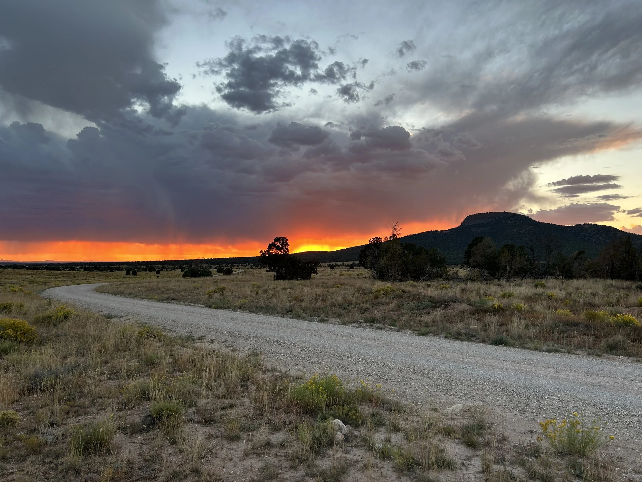
South Rim Capes of the Canyon - Day 1 - Sunset at Red Butte with Autumn Thunderstorms
Date: 10/7/2023
37.44 Miles
1,394 Feet of Gain
Tusayan, AZ to Red Butte in Baaj Nwaavjo I'tah Kukveni National Monument
The monsoon season this year proved to be above average. Notably, Tusayan (as a sample of the region) received an afternoon storm in mid-August that dumped more than 3 inches of rain around the washes of the town perimeter in about 45 minutes. A subsequent flood gushed into town permeating buildings/businesses. That surge of water also ended up being a harbinger of erosion; many parts of the South Rim region's lesser-used dirt roads were infiltrated with debris flows, flash flooding, and deep rocky ruts. I spent late-August through September riding portions of the COTC that I suspected were deeply impacted by the above-average moisture. And man, the roads were destroyed. I rode out to several remote areas on the route that had miles of debris overlaying the route or were rideable but completely jolting from the major rock beds now making the majority of the surfaces. I poured over maps, rode out to new areas, and ultimately ended up completely regrafting big chunks of the southwest and southeast passages of the COTC onto more suitable roads for riders. The result had some trade-offs, exchanging quality road for loss of unique scenery.
Ultimately, serendipitously, I think the rains actually forced a better overall quality of route for most bikepackers. The only thing left after day-ride-scouting was to do a proper multiday trip on the South Rim Capes.
I raced in the Stagecoach 100 in mid-September, only to crash at the start of the race such that I landed on a metal water bottle and absolutely crushed it flat with my left hip. The pain was bad but I finished the rest of the race. A few days later, the pain increasing, I made my way to the doctor's where they suspected I had torn my hip or labrum cartilage down in. An MRI was necessary to confirm, but I concluded that my Fall Break plans of bikepacking the Bears Ears region was highly suspect for safety and risk. I took a couple of weeks to rest and got some major improvement in the hip. I decided to use my Fall Break to ride the South Rim Capes. I wanted to do ride the whole route again, feel the new pieces I had recently moved, soak up the brilliant fall happening this year, and it was close enough to home that if my hip flared up (as I would find later that week), I could easily bail.
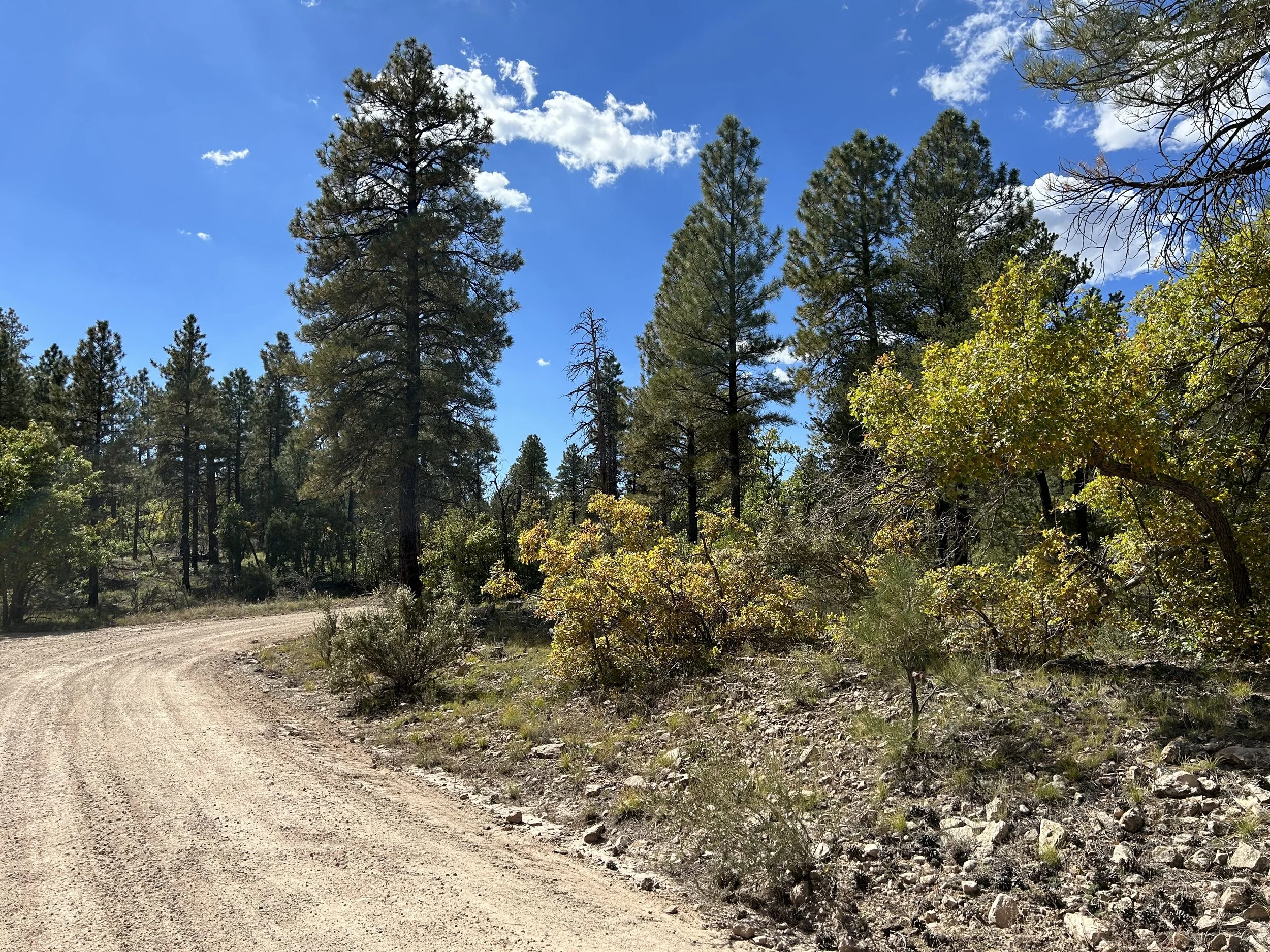
After a late night drive back to the Canyon from Phoenix, I woke up, had a slow morning, and finally starting packing before driving down to Tusayan for the start. By the time I threw my legs over my rig, the day was nearing noon. And it was a glorious mid-day of Fall at that: Aspen changing down the streets of Tusayan along with late flaring bronzes of golden rabbitbrush everywhere. The air was calm and the skies blue. This was in spite of the fact that the weather forecast was calling for nearly daily monsoon-like thunderstorms each afternoon even as it was October. I turned off pavement and started the climb out of town in to the Baaj Nwaavjo I'tah Kukveni National Monument.
All along the corridor of ponderosa pines stood bushels of oak that were putting on metallic overtones of gold, copper, and rose. The day had to be mid-70s and no one was driving down the backroads of the Kaibab. Even with this being October, dozens of flower species persisted in new and holdover blooms from the summer. Entire carpets of autumn-drying meadows were plush with white and yellow petals. New sprigs of lupine dotted the forest floors with purple and holdouts of paintbrush sang red amongst the browns and greens. And the rabbitbrush though pale in some areas was still vibrant and newly pushing blooms in others. After smoothly and slowly making my way through the changing colors of the forest, I crossed the highway, and started down to Anita Station. The ponderosas quickly transitioned to fields of sage interspersed with juniper and pinyons.
I came out of a wash and entered the rolling hills of Coconino/Chino grasslands. The grass was perfectly dried yellow from the autumn change. Ahead, a massive gaggle of clouds grouped darkly on the horizon. Amidst the bruising cumulonimbus was the dispersed faint haze of fire from a prescribed wildfire burn east of my position. The stark contrast of cloud, smoke, sage, grass, and pinyon made me stop my bike over and over again for photos. It was hot for sure - easily 80 degrees F at this low point on the route. The distant shapes of the San Francisco Peaks and Bill Williams Mountain faded away as the thunderheads distant draped rain curtains.
The South Rim Capes turned to meander east towards the clouds. I stopped to take photos of the storm clouds and strong Sun, only to turn and realize a significant storm system had developed immediately behind me in the past 30 minutes, and the tailwind I was enjoying was the outflow from it moving in my direction. I picked up my pace to keep ahead of the falling rain. I kept turning to stare at the shear mass of clouds barreling upwards and outwards into the atmosphere. As late afternoon was getting on, I crossed the highway and began swinging southward around the northern face of Red Butte. The fields of grass and sage swathing its base were memorizing in color starkness to the shaded peak above them. I didn't want to get caught in peanut butter mud so I made my way around the base and began swinging east into the storm dissipating before me as the one on my flank grew.
I reached a line of pinyons and junipers just off the road. Although only 30-something miles into the day, I didn't want to push my hip too much, and with the approaching storms, I wanted to get a shelter up, so I took a C road back into the trees and vetted out a spot to camp with good wind protection. I set up camp and then gazed through the trees at a quickening display of orange and magenta. I realized an epic sunset was coming down angularly through the storm around the profile of Red Butte. I sprinted out to the road and raced out into the adjoining grasslands to catch a truly spectacular evening glow happening. The curtain of rain from the storm had settled to a slow pause of movement just west of me and Red Butte. Here, scale-cells of cloud swung upwards in blue-gray while the sun's rays came shooting through the hazy fall of rain. It produced a rich smear of red, orange, and purple that carried out horizontally across the plains while repeating lightning strikes went cloud-to-ground beneath it all. I was absolutely riveted by the scenery.
Photos snapped before I just sat down amongst some rabbitbrush to take it all in until the last color closed on the horizon with the sun's passing. It was then that I hurried back to camp to eat some dinner in the gathering dark. I checked weather on my phone and say that the storm would eventually make its way towards me as a strong cell already evident by the flashing lightning and boisterous thunder cracking the dark night from here to Flagstaff. Food consumed and camp cleaned up, I made sure the tent was well-staked one last time before climbing in as wind hit the trees and steady patter of rain started. A lone male bull elk began calling in rut a hundred feet away. I had never heard an elk call so continuously. He would call nonstop (only a second or two for breath) for the next six hours while the storm swept over us.


