Crazy Jug Overnighter
Route Guide
Location
Grand Canyon - North Rim, Arizona, USA
Physical Difficulty*
5/10
Days to Ride
2 Days
Technical Difficulty*
5/10
Length
72 Miles
Tire Size
Recommended: 2.2"-2.6"
Seasons
Best: Mid-May - Mid-Oct.
Not Possible: Late October - Late-May
Elevation Gain
6,014 Feet
Primary Surfaces
Smooth Gravel; Rough Gravel
*Based on Bikepacking Roots’ Route Rating Scale
2. Route Description
Crazy Jug Overnighter provides riders a chance to camp rim-side at Crazy Jug Point along the Grand Canyon's North Rim. The route also provides short hikes with vast views from Monument Point and Thunder River.
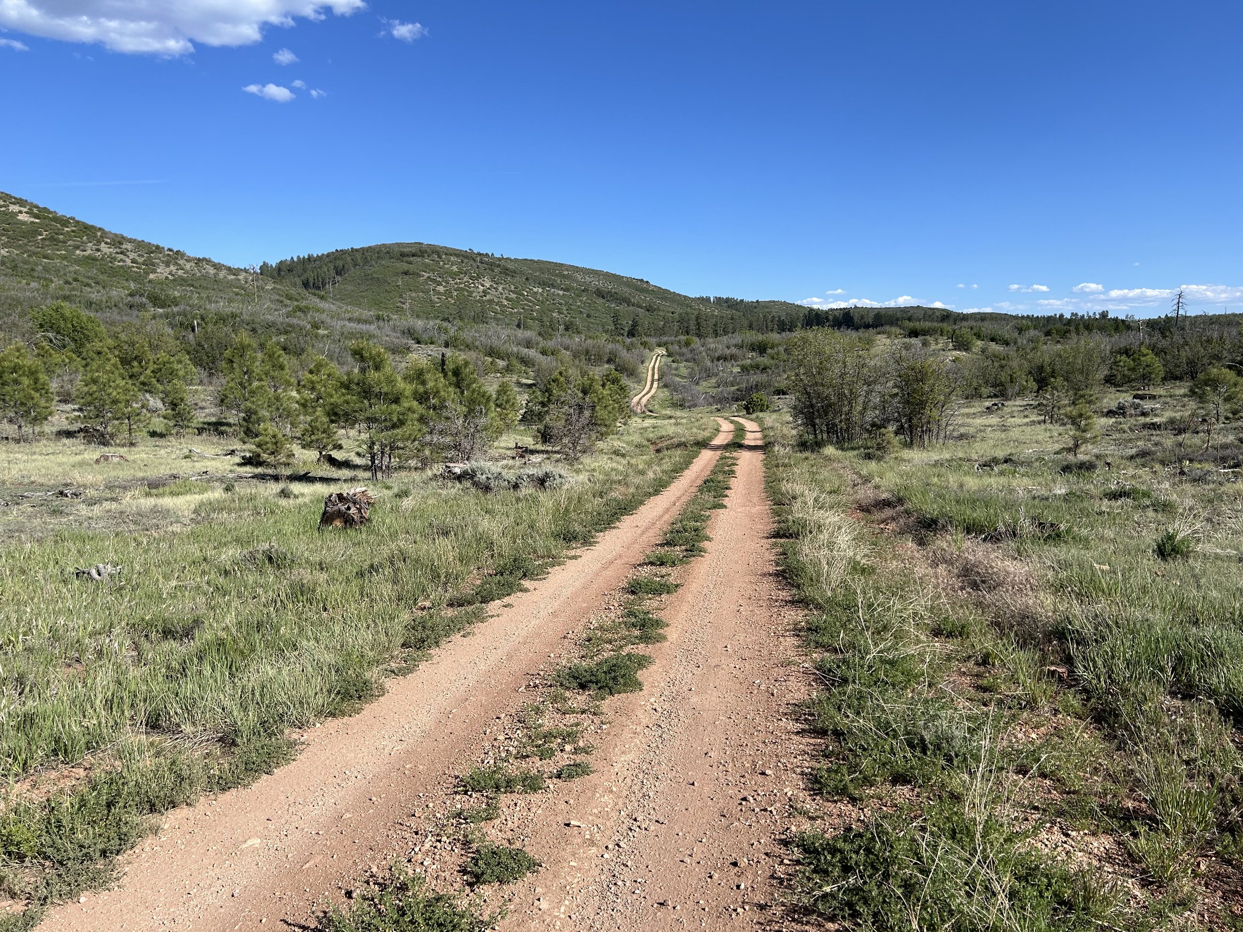
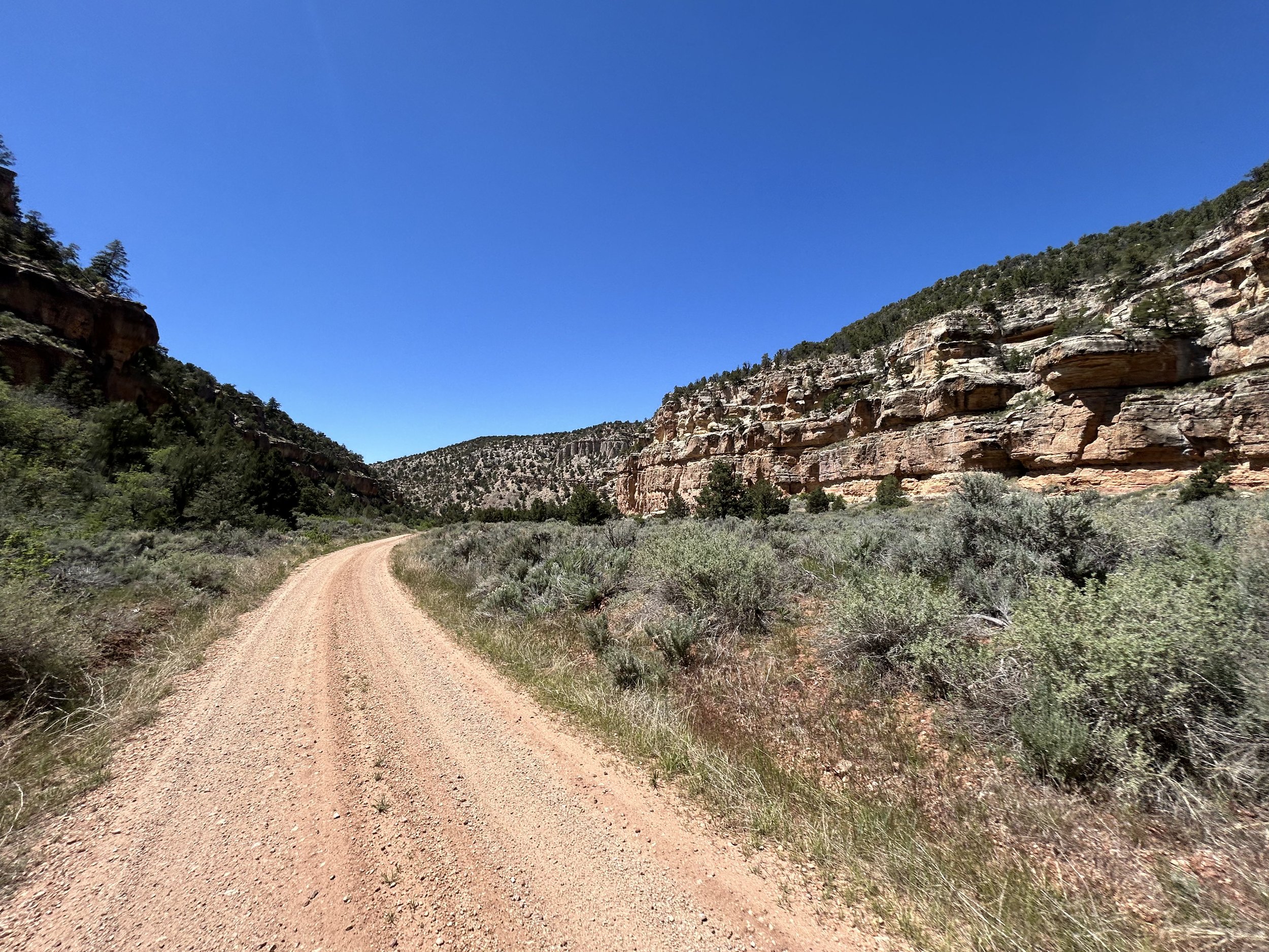
Bikepackers start near Big Springs where a ride down geologically beautiful Nail Canyon takes cyclists out to more remote FR 423. Miles of dirt road and doubletrack wind across plains of cliffrose and into thickets of pine. Ultimately, riders make their way into thick ponderosa forest where a side-ride provides water and a view from Thunder River. Then, it's back out to smooth dirt past an abandoned cabin for a climb to Crazy Jug Point and a night out rim-side under the stars. In the morning, bikepackers will continue down to the Bill Hall Trailhead where a short hike carries them to an expansive overlook of Crazy Jug Canyon at Monument Point. Riders finish the route with a long climb in the pines that carries them up into the aspen before a quick and smooth descent on FR 22 back to Big Springs.
Highlights:
Views of the Grand Canyon from Thunder River, Monument Point, and Crazy Jug Viewpoint
Staying at Big Springs Cabin Site (historic USFS cabins for rent)
Riding down geologically stunning Nail Canyon
Dispersed camping at Crazy Jug Viewpoint under dark skies on the North Rim
Potential for hikes on the Bill Hall and Thunder River Trails
Biking through thick woods of ponderosa pine, spruce, and aspen
3. Map and GPX
-
Purple = Improved Dirt Surface (Frequently Maintained, Usually Smoother)
Red = Rugged Dirt Surface (Infrequently Maintained, Typically Rougher/Rockier)
Brown = Primitive Dirt Surface (Rarely/Never Maintained, Particularly Rocky/Rutted/Eroded)


4. Route Difficulty, Surface Conditions, and Direction to Ride
Route Difficulty
Physical Difficulty = 5/10 (Rugged terrain with frequent climbs, some of which may be steep and unrelenting)
Technical Difficulty = 5/10 (Continuous sections of track may be rocky, loose, and steep; (e.g., 4×4 roads or singletrack in rugged/rocky terrain) suitable for riders with intermediate off-road experience)
The technical difficulty of the route is due to the presence of short sections of chunky doubletrack.
The physical difficulty is mostly due to the climbing. The climb from Crazy Jug up to the intersection of FR 206 is nearly two thousand feet of gain and will take some time.
Noteworthy Climbs
The climb from Thunder River Trailhead up to FR 425.
The short, steep climb from FR 425 on FR 272.
The cumulative climb from Crazy Jug to the intersection with FR 206.
Surface Conditions
Crazy Jug Overnighter travels down a mix of dirt Forest Service roads. Some of these roads are regularly maintained, wide, lightly graveled, and sometimes hero dirt. The doubletrack is often smooth and undulating. However, there is one section of notable chunk as riders climb up into the aspen along FR 272 from Crazy Jug. All roads in this area are often littered with tree blowdowns come early summer. The deadfall will get removed, but anyone traveling in the early season may have to go around/over trees until agencies clear them.
Noteworthy Primitive, Rocky Surfaces
A short, but extremely steep and rocky section from FR 425 up on FR 272.
Direction to Ride
The route is intended to be ridden in a counterclockwise direction.
5. Parking
Park your car overnight at a dispersed camping pullout in the woods south of Big Springs Cabin Site. If that site is taken, you can find alternative parking at Castle Spring.
6. Water and Food
Water Reliability
Water is scarce along this route. The Kaibab National Forest is considered the driest national forest in the United States. Although the North Rim is higher than the South Rim and consequently receives an average of 25.8 inches of moisture a year, most quickly percolates through the porous rock of Kaibab Limestone that makes up the upper layers of this area. Plan to carry several liters of water, enough to last you at least 24 hours.
Almost all water sources on this route are only seasonally available, and only if there has been good winter snowpack. Plan to carry almost all the water you'll need, just to be safe (especially if there has been a drought or it has been hot and dry).
Water can be found at Parissawampitts and Big Springs, as well as several wildlife tanks along the route. Additional sources can be found in dirt cattle tanks, unlisted springs, and unreliable seasonal creeks. This route requires riders to dry camp.Beyond these sources, water may be found in dirt cattle tanks, unlisted springs, and unreliable seasonal creeks. This route requires riders to dry camp.
Food Resupplies
There are no food resupplies along this route.
7. Fees and Permits
Kaibab National Forest has no fees.
8. Important Information
Hunting Season:
Starts in September and goes through December. Hunters will mostly be seeking deer and elk. Expect to see more trucks, backcountry campers, ATVs, and individuals on foot. WEAR ORANGE and make yourself visible as you ride. Be smart and be seen during hunting season. Wildlife Tanks may have more hunters scoping them out.
Bugs:
Mosquitoes and biting flies can be abundant on this route in the forest valleys and drainages where moisture and standing water collect. This will be especially true in the summer and early fall, especially if precipitation has been plentiful.
Dark Skies:
Grand Canyon National Park is an International Dark Sky Park. This means that you can expect to have anywhere between Bortle Class 1 - 3 night skies overhead (even better night viewing during a new moon). The Bortle Class Scale is used to rate night skies on their clarity and lack of light pollution. A Bortle Class 1 is the darkest possible and there are several locations along these routes where, should you camp, you will have this level of darkness. Here, night skies will be virtually unimpeded by artificial light. You can use the following sites to explore more:
Black Bears:
There are black bears which means you need to properly store your food at night using a bear-aware method.
Fences:
There may be "cowboy fences" on this route which consist of barbed wire wrapped around vertical wooden branches that are strung across roads. They can be opened by removing a loop of wire on one side. Most importantly, leave fences as you found them; re-close them if they were closed.
Hantavirus and Plague:
Bubonic plague and hantavirus are frequent enough amongst the rodent population that you should avoid their saliva, feces, urine, and direct bodily contact. Be careful when entering old cabins and caves where droppings are plentiful and ventilation is limited. These are prime areas for possible contraction of these diseases.
9. General Access and Tribal Nations
You are allowed to cycle on any established dirt roads.
Bikes are STRICTLY forbidden below the rim in the inner gorge of the Grand Canyon. DO NOT RIDE YOUR BIKE DOWN INTO THE CANYON - you will get fined, it is illegal, and you will hurt the perception and opportunities of other bikepackers on this route. Practicing Leave No Trace means staying on established trails, roads, and paths.
I must note that although this route stays on "public lands," the formation of Grand Canyon National Park and surrounding land designations involved the forced removal of tribes such as the Havasupai, and they have endured legal battles to keep their vastly smaller chunk of land out of their historical precedent. Know the land you are riding on is traditionally theirs, know their current reservation boundaries are smaller than where they historically inhabited, and know where you are riding to keep yourself both legal and respectful.
10. Camping
In the Kaibab National Forest, excellent and numerous dispersed camping abounds. The North Rim is truly one of the most remarkable places for dispersed camping right up against the edge of the Canyon at numerous locations for those making the remote trek out.
11. Sample Route Itinerary
This is a suggested itinerary. Use it as a rough guide for your own planning purposes. Feel free to use it, adapt it, or don't use it all and make your own plans. Plan your trip on this route based on your own strengths, comfortabilities, experiences, wants, and needs.
-
Mileage: 39 Miles
Elevation Gain: 3200 Feet
Water: Big Springs; Wildlife Tanks
Resupply: None
Camping: Dispersed camping at Crazy Jug Point
-
Mileage: 34 Miles
Elevation Gain: 2800 Feet
Water: Parissawampitts Spring; Dirt Tank
Resupply: None
Camping: Finish! Reserve a cabin at Big Springs Cabin Site or diserpsed camp nearby.