Stagecoach 400 - Day 4 - Coyote Canyon, The Willows, and the Climb to Idyllwild in a Winter Storm
Date: March 12, 2024
49.5 Miles
6,803 Feet of Gain
Borrego Springs to Idyllwild, CA
The Santa Ana Winds are here. And they are powerful.
The night is a swirl of gusts and flapping fabric. The X-Mid holds secure - success born of its design and our campsite choice. But the winds just continue to grow throughout the night. I shove earplugs in deep to drown the sound of gusts whipping. The heat of the desert dies in the night; it's replaced by a chill from wind and storm front. I awake to use the restroom several times and tighten all guylines each time. But I sleep, and so does Janna. My eyes are already open when my alarm sounds at 5:30 am. The two of us decided to wake up extra early for several reasons: (a) today is the crux of the route with The Willows, (b) today will also hold the most elevation gain per our plan, (c) the Santa Ana Winds will be at their worst for us, and (d) the latest weather report warns of a significant winter storm brewing over the San Jacintos threatening several inches of snow and whiteout conditions. The Santa Ana Winds alone are against our favor - literally predicted to be blowing all day in exactly the opposite direction we are moving. We mentally brace ourselves for 25-40 mph headwinds with 50+ mph gusts. I ponder our fate after our alarm goes off. It's nearly night still, the break of dawn just barely here.
I'm tense with excitement and anxiousness. Will the Willows be as legendary as they are made out to be? The sandy sections? The thickets and mud? Will the climb to Idyllwild be as epic as it felt when we did the Sierra Cascades a few years ago? When will the wind become the worst? Janna and I often describe these crux days of a route as great unknowns where we think, "I have no idea how today is going to end or how we'll get there." I sit up and have this impression immediately. I just know today will end and when it does, we will lay down.
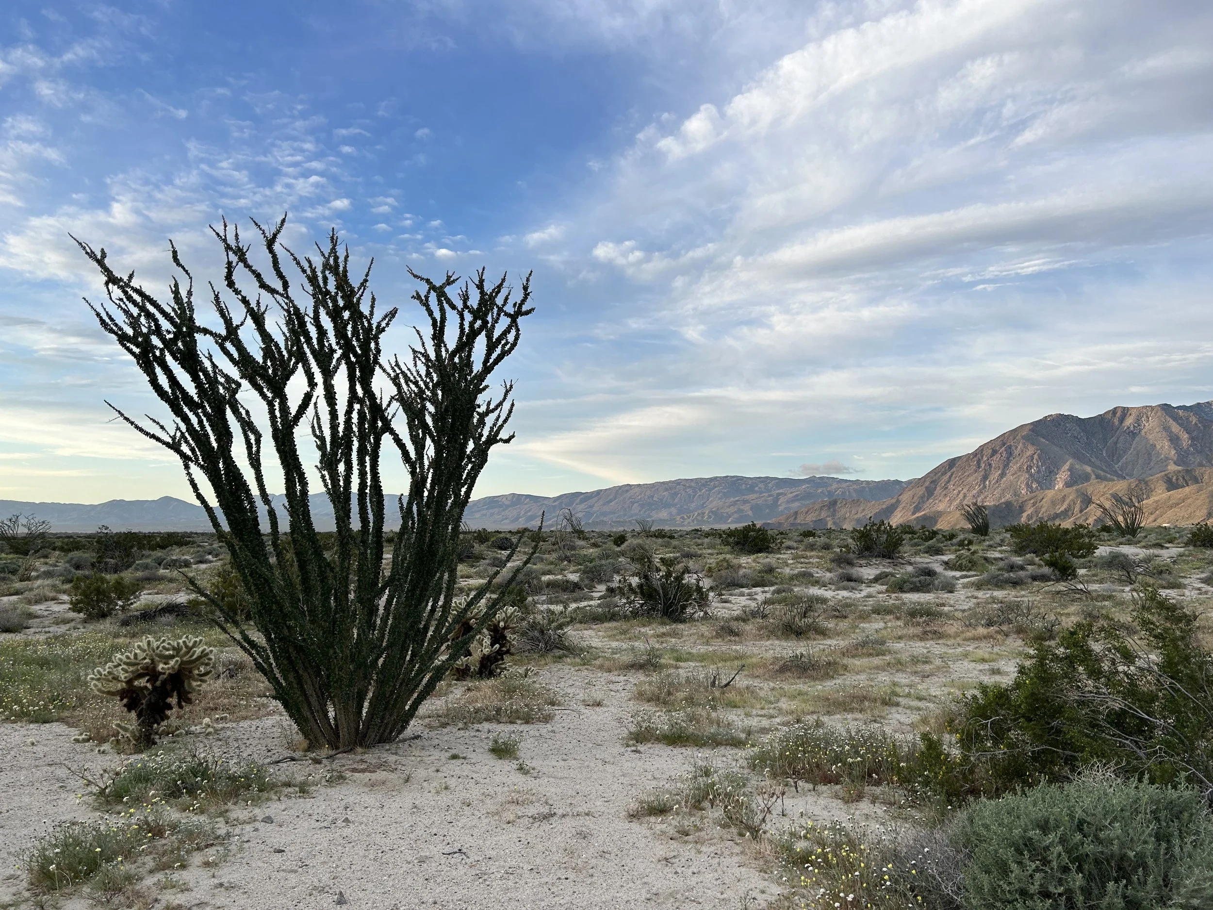
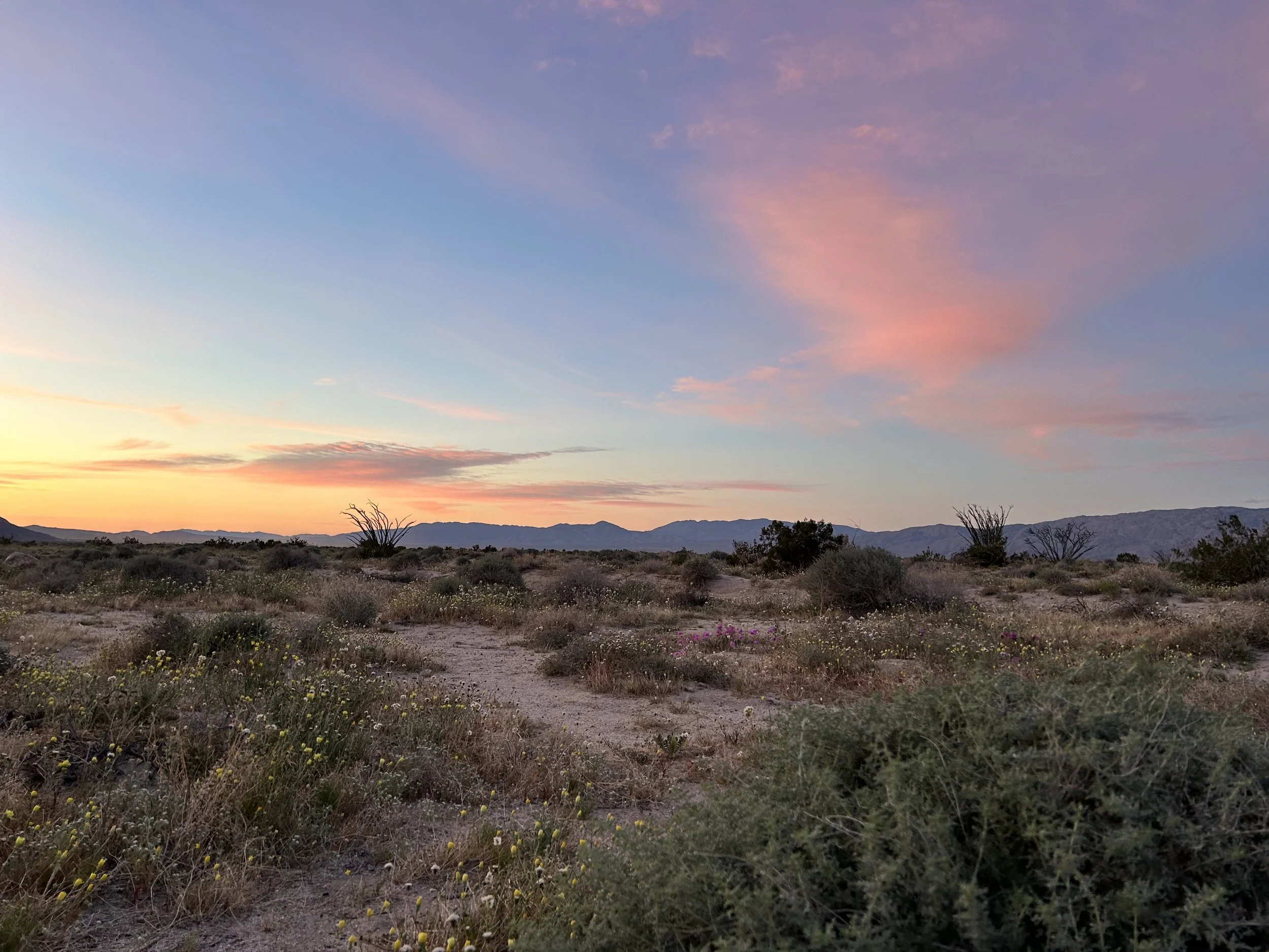
I give myself 30 seconds to ponder this, and Janna is on the move next to me. She packs so I pack. We move quickly, methodically putting our gear away as wind continues to batter the X-Mid. I step outside into the crisp air of morning and stare at orange sheen to the east. Our way is west, into the wind. I pack everything on the bike and save the tent for last as it'll be a hassle to take down in the wind. As light creeps across everything, I suddenly realize we are smack in a blur of blooms. Flowers cup their petals tightly and unfurl them with sunrise. It's absolutely beautiful, a rich bouquet I was hoping to see with this season's rains here in the desert. The sky draws ink to purple and cotton candy pink. It then burns yellow to blue with orange cloud. Then the peaks burn sulfur in the first rays of direct light. The scene is beautiful and quickly evolving as high cirrus clouds pass quickly overhead. Their movement transform light, scenery, and glare so that every turn of my head brings new views to my eyes. It is a spectacular morning because of the storms.
As I continue to pack, Janna announces she's going to start riding. And by riding, she means pushing her bike against the wind. The road is only a gradual incline with a relatively firm surface, but those gusts are so strong it's not worth riding. So she walks. I struggle to get the billowing tent into my panniers. Then, it's one last look around before I start walking too. Mesquite is blooming along the side of the road in addition to the carpet of primrose and poppies. But every plant is bent backward from the force of wind. We finally round a bend just enough to cut the current to jump on bikes and pedal on granny gears. The cirrus clouds stretched overhead cast washed-out shadows on the pallid landscape.


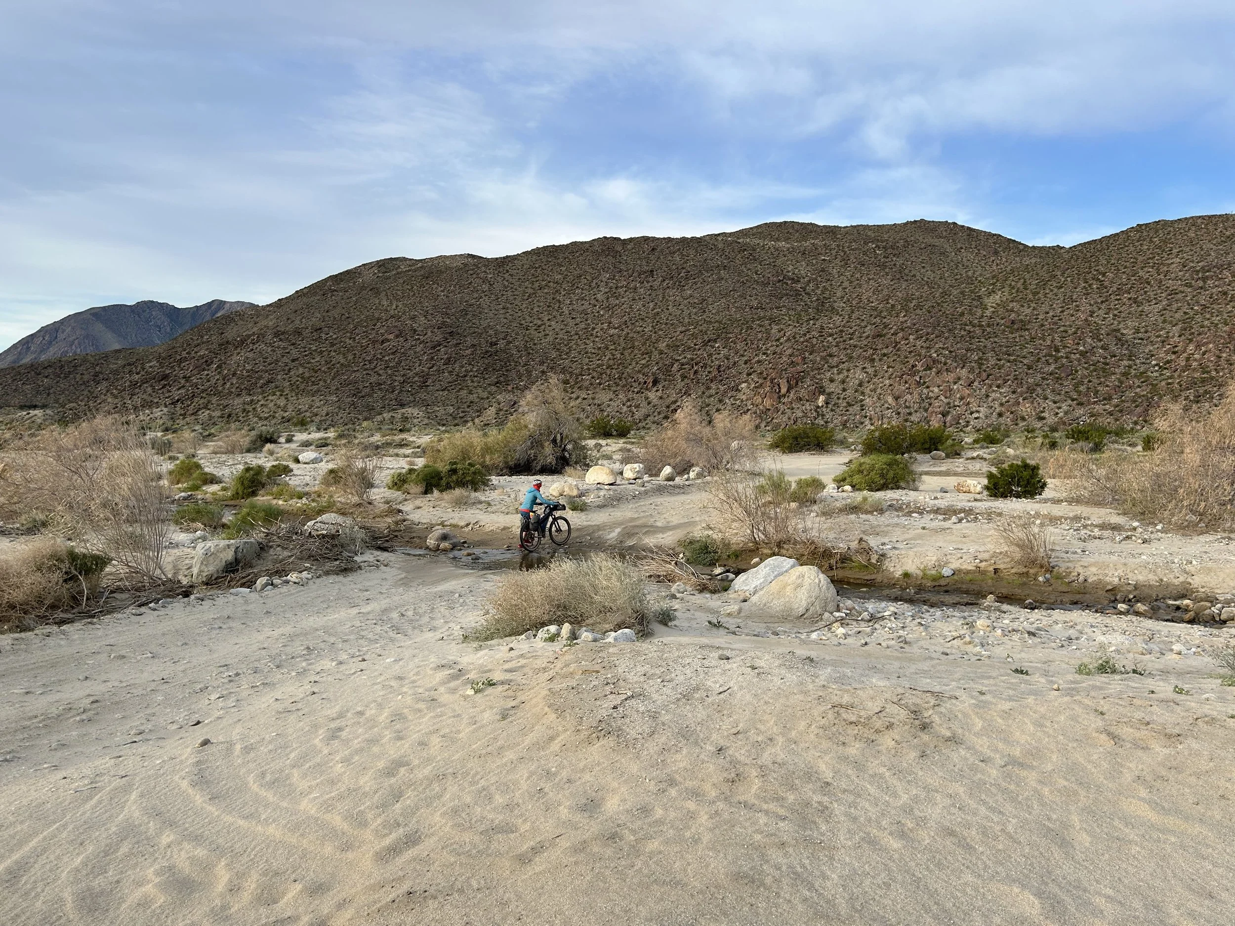
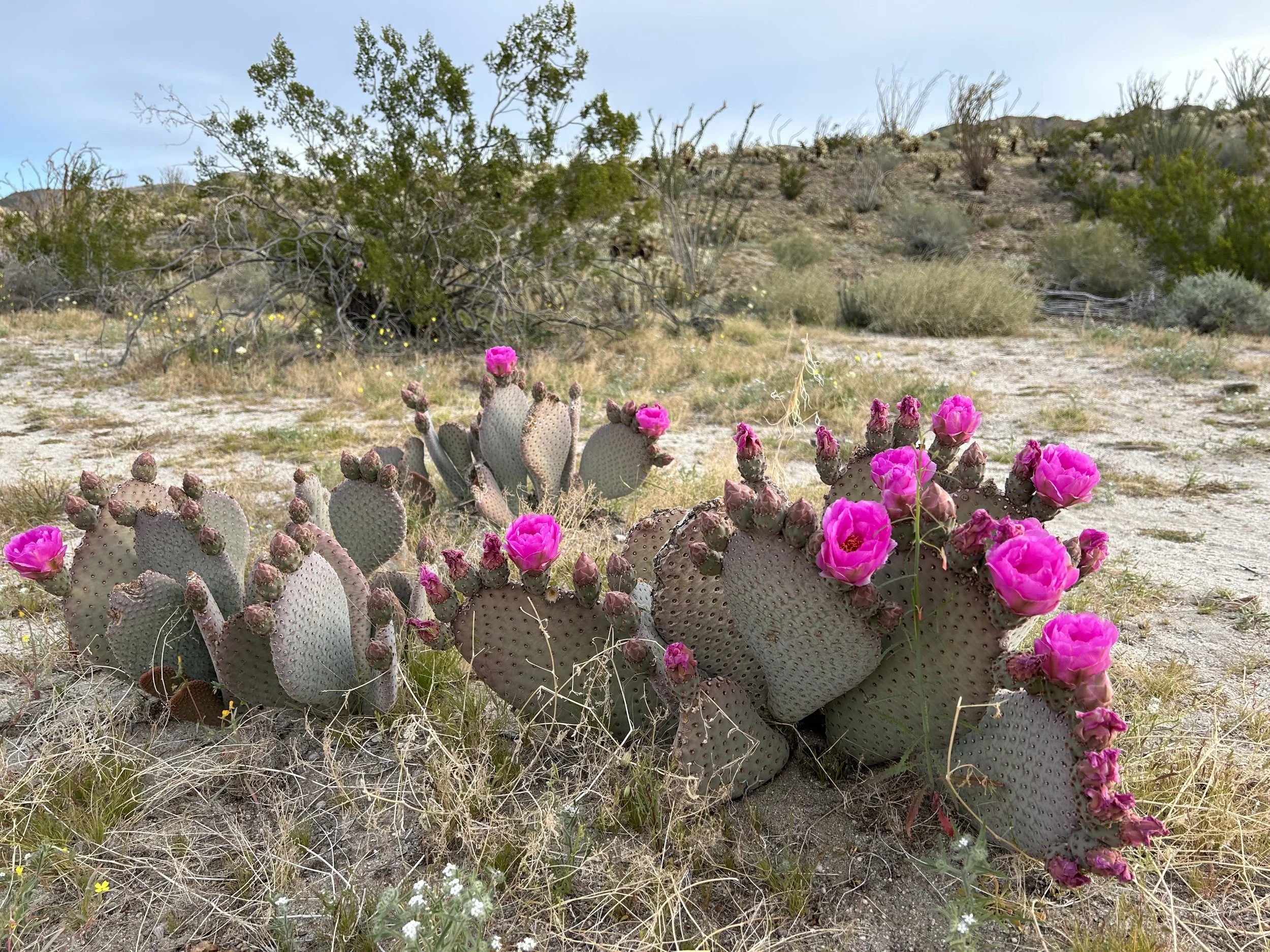
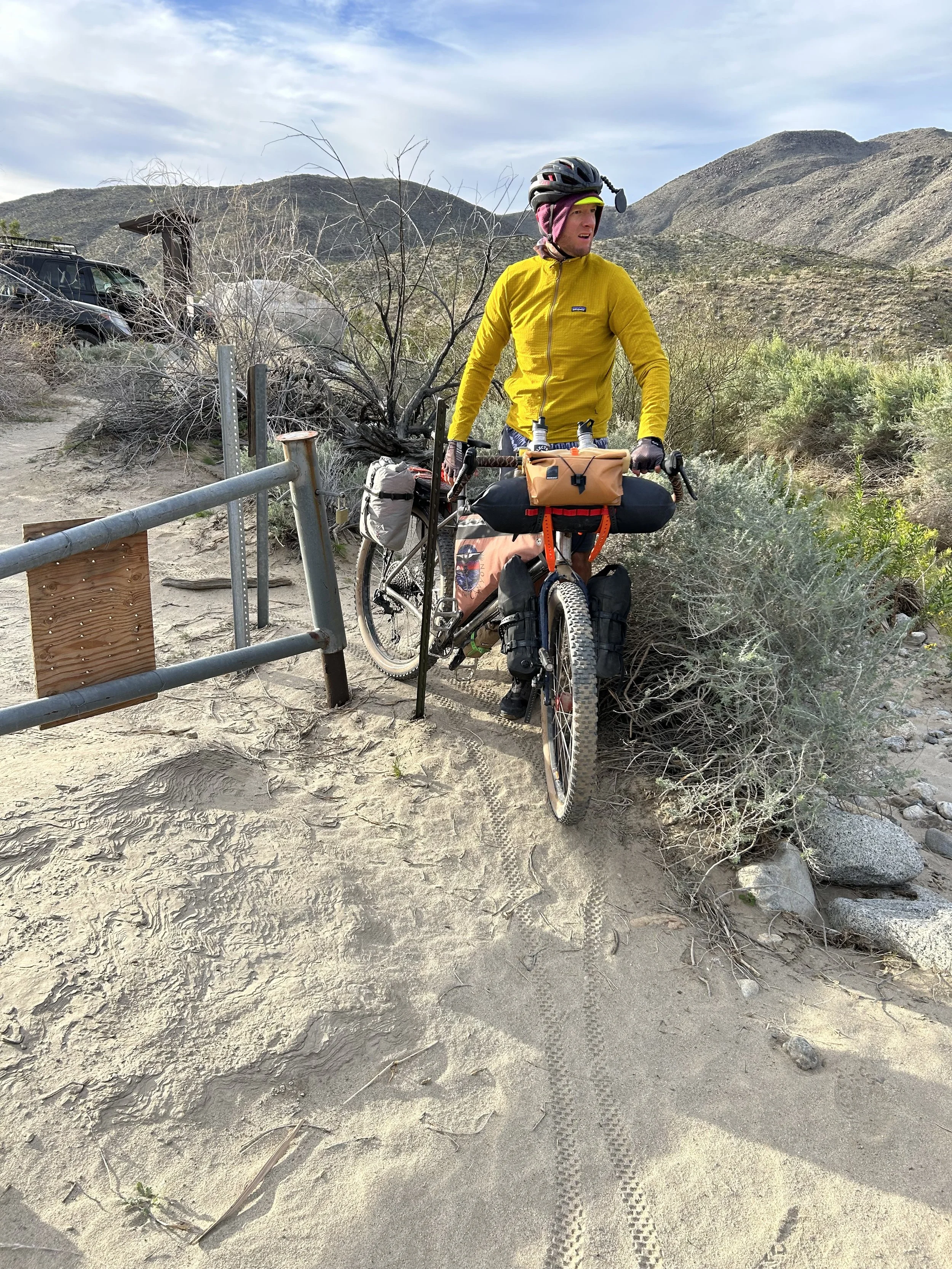
We arrive at the first flow of Coyote Creek. It's a simple crossing and the creek is strong. Purple verbena and prickly pear bloom nearby. We cross and make our way into Ocotillo Flat along Coyote Canyon proper. I cannot get over how beautiful and green all the plants along the creek are. Still, the road is rideable as we walk across and then continue riding slowly into the wind on a beautiful dirt surface. The further up Coyote Canyon we go, the deeper the water gets and the lusher the spring vegetation. I'm tripping on curiosity to see what this area looks like. I keep imagining that the Willows we be around every turn of the road - a smack of stop that will require us to walk. But instead, the road continues on. Which honestly bolsters my soul as it means more miles covered. But we round one more corner near a small dirt parking lot where a fence crosses the road announcing the true beginning of Lower Coyote Canyon and its seasonal closures in summer. This is it - the start of the legendary section.
Janna and I go around the fence where the road quickly dissembles into a mat of sand and river rocks. We push our way parallel to strongly flowing Coyote Creek. At this point, any semblance of trail begins to disintegrate as the route becomes overgrown singletrack coiling and curling through desert riparian scrub. I can see the print of old bike tire tread which matches the GPS track - so we make to follow it. The route meanders next to yellow blooming brittlebush and small chollas. It's incredibly beautiful at the creek with the light of morning softened by the high cirrus cloud cover. Down here along the wash the wind has no bite. The Stagecoach 400 veers left, away from the creek, where a sign indicates no bike access to the Lower Willows. Instead, we're funneled up a sandy side-wash that starts uphill between two hillsides. We round a corner and stare at a jumbled pile of boulders, river stones, and sand cascading down from a small pass, and I realize we have to go up it. It's straight hike-a-bike for me as I carefully plant my feet in soft substrate and then exert to push my bike up past me, grab the brakes to keep the bike from slipping back, and then hike up next to my rig. I repeat this process over and over to climb up this pass. About a third of the way up, the wash becomes a powerful wind tunnel as the Santa Ana winds come barreling down Coyote Canyon and then spill through this cleft. The winds are so powerful I can barely hear Janna calling out behind me. Again and again it's stand, push my bike with my upper body, grab the brakes, and then hike up next to it. By inches and feet we gain the pass. I realize then how much Coyote Canyon is going to require of us as we are only on the lower third of it.
Eventually, I crest the pass where the rocky/sandy route takes on a tamer quality as it flattens and widens into a rideable section between the adjoining hill peaks. The wind isn't so funneled now that the pass is opening up - it's strong, but not battering. I can actually ride my bike again as the Stagecoach 400 is like rollers dipping between ocotillo stands. Then starts a descent down to mesmerizing Collins Valley. The desert plain is a wide spread of saltbush, mesquite, agave, and beach sand spread over a wide area all cradled on four sides by mountain peaks. It's absolutely wild looking and takes me by surprise for its beauty. To our distant rights is a thicket of willows and cottonwood - the official Lower Willows of Coyote Canyon. Janna catches up to me and the two of us descend down to the valley plain. The route plunges into unrideable beach sand at the bottom as firm dirt dives below the surface of the loose. The only thing to do is walk our bikes.
Now that we're on the open floodplain of Collins Valley, there is nowhere to hide from the wind. It slices and whoops across everything both in constant rush and sudden bursts of gusts. I feel torn between exertion-hot where I want to remove my jacket and cold-shivers from the temperature of the gales. We both wear shorts and jackets, keeping the latter unzipped for thermoregulation. Push, push, push. We work our way along Coyote Canyon Bypass Road that is the sole thread available for bikes in this area where the Santa Rosa Mountains State Wilderness pushes up on both sides of us. The route is a wide swath of ankle deep sand. I try to find lines to ride but inevitably fall off my bike every 20 feet as my tires sink and even my lowest gear is slower than walking. And that's how the next hour or two go - persistent walking in the face of a powerful Santa Ana headwind through unrideable sand. The route intersects at several points with side-washes/routes including Indian Creek, Sheep Canyon, and Monkey Hill Trail. We make towards Salvador Canyon and Monkey Hill on the north side of Collins Valley. It's stunningly beautiful out, but agonizingly slow moving. I can tell Janna is aching to get through this section. Somehow, she marches ahead at a fast clip and I can't catch her.
The mountains get closer on the north side. And I find myself hoping that the route will change direction so we can get out of this insane 30-40 mph headwind. I'm literally pushing my bike at 1-2 mph. A signpost announces we are entering the Middle Willows. That feels like an accomplishment and a measure of our progress. The terrain firms up and I ride through shallower sand for a bit as the route turns northeast and cuts the wind for a moment. But then it all falls apart in wicked deep sand where I dismount and push my bike with all my strength against the even deeper sand. The wind picks up too. I'm literally hunched over across my handlebars pushing as hard as I physically can at a 1-2 mph speed up a slight desert-pan incline. I haven't seen Janna in a bit when the route rounds a corner and I see her with her bike laying sideways in the deep grit where the Stagecoach 400 stretches out eastward in a line of unrideable substrate. Just then, a mad gust of 50 mph wind makes every mesquite whip and bend, and I fall to my knees from the blow of it. Janna lets out a roar of fury, anger, frustration, and sadness, literally scream-raging in tears at the top of her lungs, "I JUST WANT TO RIDE MY BIKE!!!!!!!!!" I drop my bike and run to her. She turns and says, "I FUCKING HATE THIS WIND AND SANDDDDDDDD!!!!!" in a shrieking tear of anger and defeat. I let her cry until she says she's ready to go. "I feel so much better now that I got that out." She resolutely picks up her bike and starts marching forward into the ocean of sand, wind, and uphill at a clip I can't keep up with.


I run back to get my bike and look across the plain as the route moves to intersect with Coyote Creek once more. We make our way over and the ground becomes firmer. We can ride bikes again. And we do, for a good bit as Coyote Creek flows downhill to our rights to our uphill as the mountain rock closes in and Coyote Canyon narrows. And then we hit a literal fence crossing the doubletrack. I walk along the fence where a footpath seems to trace it. But there is no way through it. I doublecheck the GPS and realize this is where bikes are forced into the water and bed of Coyote Creek. It's a bit of a drop to get down the bank which is very rotten with crumbly rock. I head down first, and Janna slowly lowers her bike to me where I catch it and lower it down into the water. She then passes me my bike. We stand amid a thin flow of water on firm sand. Curiosity bites my interest as I imagine and wonder when we will enter the famous willow thickets that mark the crux.
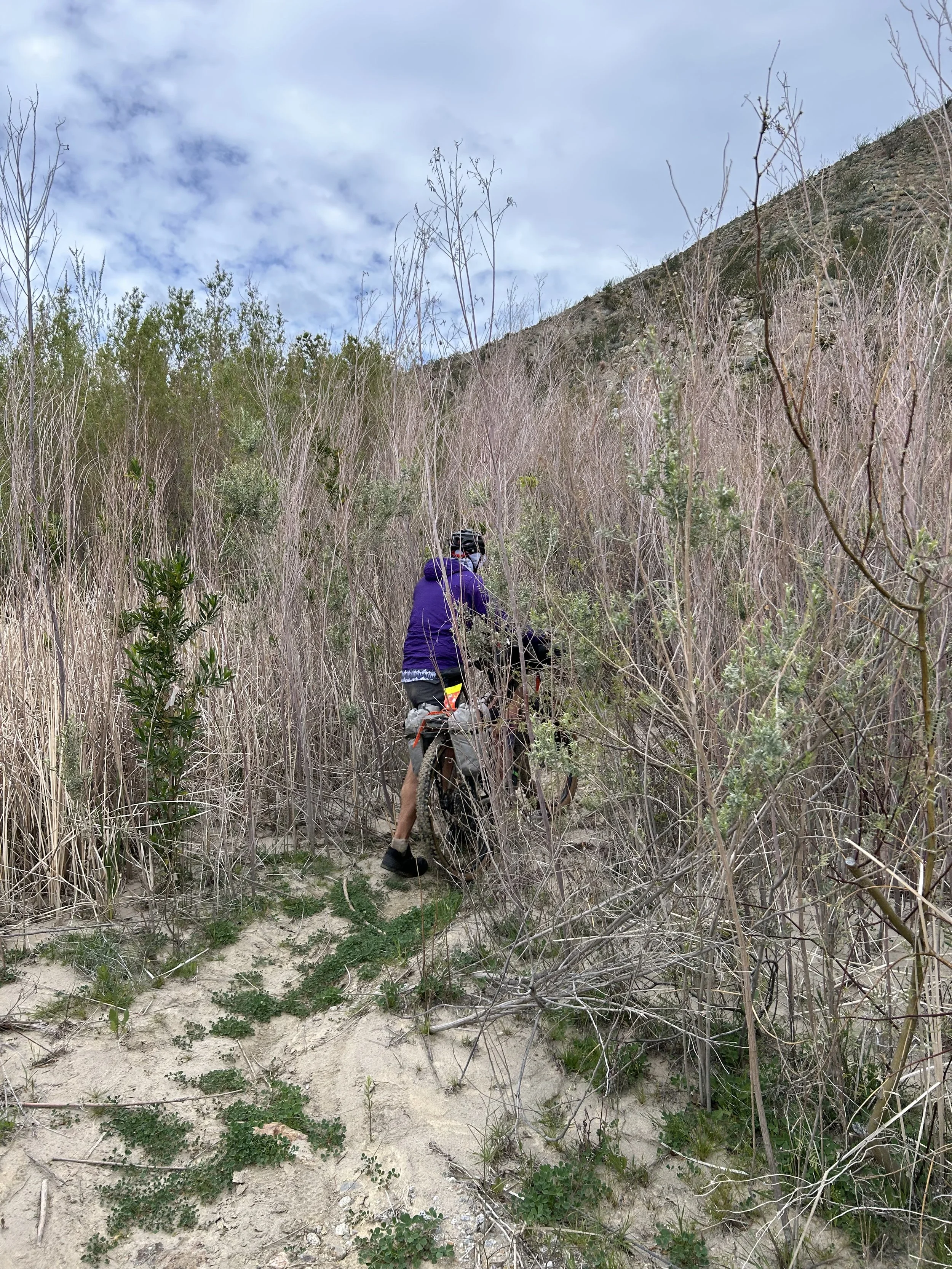
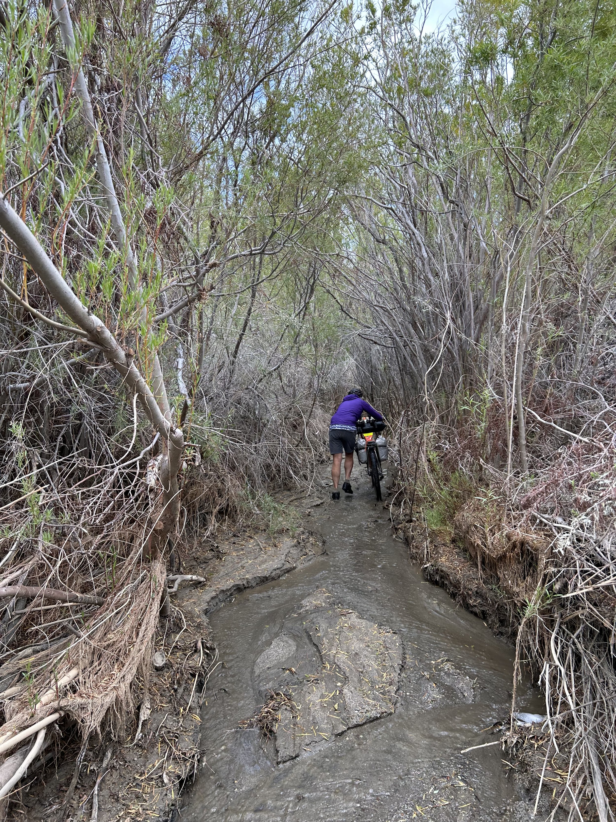
We weave and push through riparian thickets of grass and woody stems. The stream gets broken up by boulders. I work my way through these rocky sections by jumping ahead, next to, around, and behind my bike making sure to watch my derailleur to drag and push the bike through. It's often a choose-your-adventure as multiple paths weave through the thickets. Sometimes I start down one and reach a impenetrable wall of woody plants where I'm forced to turn around and try another direction. But we're making it. And this is thrilling and fun for me to figure out which way to go. And the riparian vegetation, though it slows us down, is effectively cutting the Santa Ana headwinds. It's the first calm air we've experienced in two days.
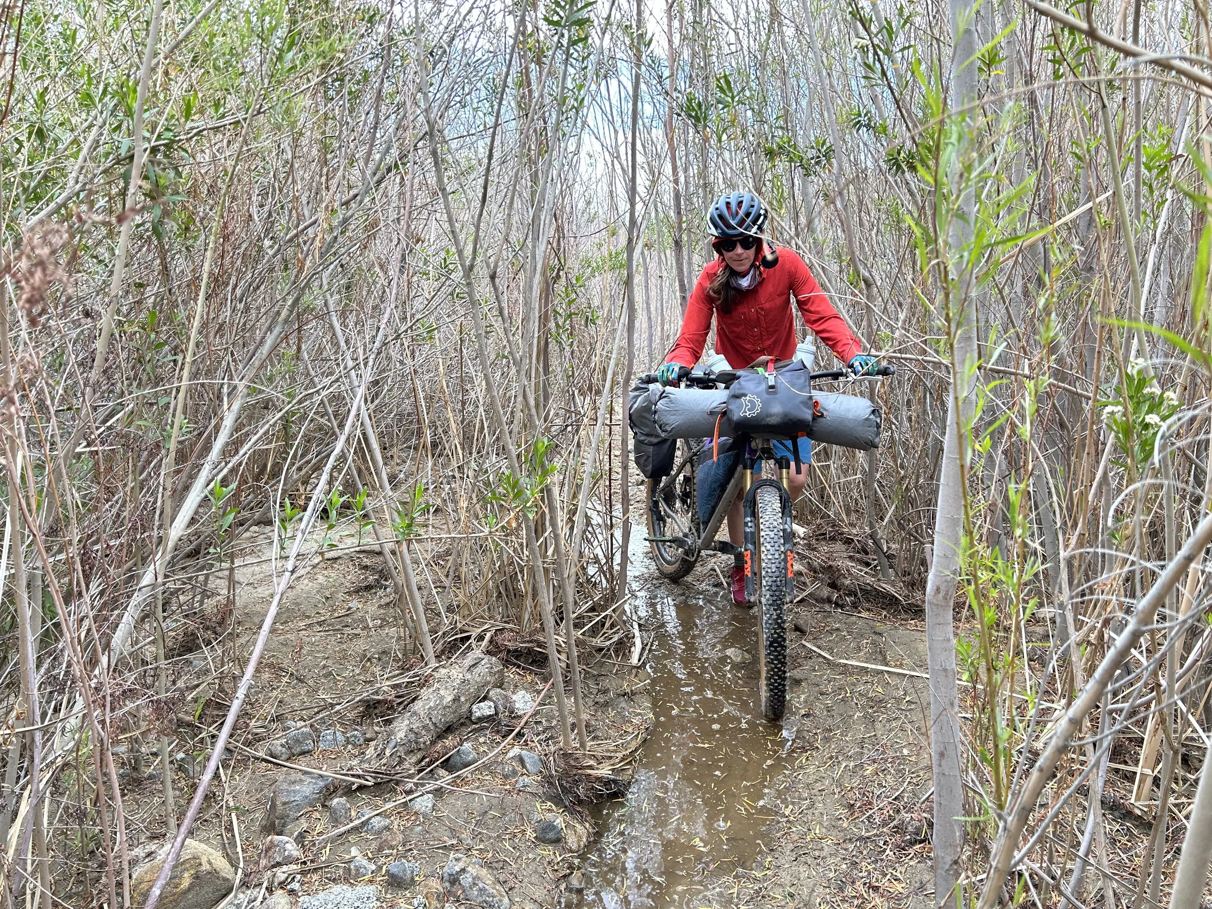
I see a large stand of creek-side trees, willow stands, and dense leaves ahead - THIS is the Middle Willows we are about to enter. Coyote Creek cuts a narrow channel through the brush. It's muddy, silty, slippery, and barely wide enough for our handlebars. I'm stoked to be finally doing this. I search for an entrance proper where singletrack splits the stems, and I'm in. Janna is soon behind me as spread stands of vegetation quickly encroach until we join a stream-path through the heart of it. This bushwacking is about a mile long and gently uphill through the coursing bed of Coyote Creek. We try to avoid completely submerging our feet by pushing our bikes down the center of the glop-mud channel and walking with our feet saddled on both sides of the thin bank. But I quickly fail and slip into the murky water. I can see tadpoles in areas and can smell the anaerobic decomposition in others. It's a soup of desert leftovers I'm keenly aware my legs are submerged in. We battle the adjoining stalks of plants as they grow closer and closer.
Coyote Creek suddenly gets deep and small but robust plunge pools appear. I climb over one and then turn to grab by handlebars and hoist the bike up. Instead, I end up slipping straight back into the plunge pool with a plop. I try from behind and stretch over my bike to direct the handlebars forward to lead my bike up over the pool. Several minutes of maneuvering, I finally liberate my bike. I walk it a few feet down the crowded channel and then turn back to yell to Janna to seek my help if she wants it. She wants to try it first independently. But she's soon calling for help as she sinks in six inches of slop mud at the bottom of the water. The water is deep enough that her bike has sank above her bottom bracket which is fully submerged. I grab the front, she pushes from behind, and we work the bike over the pool lip. We both laugh looking at how streaked with mud and sweat we are. But at least there is no wind in the Middle Willows! Instead, the wind is kept at bay - but always noticeable for the sweeping jostling symphony of stalks bending above and around us during each gust.
Its slow pushing again down a shallow portion of water where the vegetation encroaches close. I turn and snap a few pictures of Janna behind me for a visual reference. We then stumble out on an exposed sand bar with little veg. Some palms nearby are billowing and bending from the strength of the wind and the sky darkens. I suddenly realize that the impending storm could dump precipitation high up that could come guzzling down Coyote Canyon in rapid amounts - and this narrow channel is no place to be in a flash flood. I tell Janna we need to move, now, to get out of this section in case of rain. We push on and plunge back into another, more tree-dense thicket. Coyote Creek is sandier, shallower, and wider here, making for faster travel. However, there are several downed trees stretched ankle/waist/chest height across the channel. Janna and I scoot around and under them if possible. One has a sizeable mid-girth arch that makes it just possible to lay our bikes on their sides and have one person push from behind while one person pulls from the front to pass each of the bikes under. Another is angled so that they only way around is by carefully lifting our bikes over. But I'm honestly loving it. I keep thinking it's stellar route diversity and desert ecosystem uniqueness that makes the Stagecoach 400 special.
And just like that we round a bend and walk out of the Middle Willows into a large open expanse of sandy desert wash - the end of the thicket. We had now gone 11 miles for the day and it had taken us about six hours. The two of us speed along firm sand packed down by recent precipitation. Again, it is path-finding per person as the route carries us up Coyote Creek's streambed among jumbled boulders, rock deposition, ruts, and back into thick deep sand. We stop for a break to eat an early lunch and rest after making it through the Middle Willows. We sit on an embankment and eat snacks under now bluer skies. The wind is blowing, but as not as strongly due to the blocking quality of the surrounding desert hills. It feels slightly chilly. A change is occurring to the temperature. The clouds are rapidly alternating between lower cumulus and high cirrus overhead. Our legs are streaked with mud, and I'm hearty with our accomplishments so far.


But realizing it took so long to cover so little ground, a pushy sense of urgency and concern to bike takes hold of us. Janna and I discuss how many miles we need to cover and in how much time. We're still sitting on the bottom of Anza-Borrego Desert State Park and we need to climb up into the montane forests of the San Jacintos. I pack up behind Janna and we pedal forward.
"I'm so grateful that the sand is firm here from recent rain," I say.
"This would be so hard to bike up if it was all soft sand," Janna replies.
It's sandy as ever, but we easily cover ground on firmer finds. Even then, the wash chokes up with a collision of massive stones and rocks forcing us to hike-a-bike and walk through them to find the path of least resistance. I'm laughing out loud about how absurd this is that we are biking a "route" as it feels like we are just riding up the vein of some desert riverbed out in the middle of nowhere. If it wasn't for the GPS track encouraging us forward through gardens of stone and sand, I'd think we were randomly biking into desert nothing. I'm laughing but also really just enjoying how beautiful it all is. For real - it's crazy rocky and sandy, but wow is it also stunning with the yellow washfloor, blue skies, and white rock-hillsides all sprinkled with green vegetation. Janna calls me over to take a look at a large, old rock monument - turns out it’s a historic marker for the Anza Expedition. We push north as Coyote Creek broadens with steeper, taller banks. The sand beneath our wheels dries and deepens. We're back to hike-a-biking or pedaling on granny gears through whatever lines we can make work.
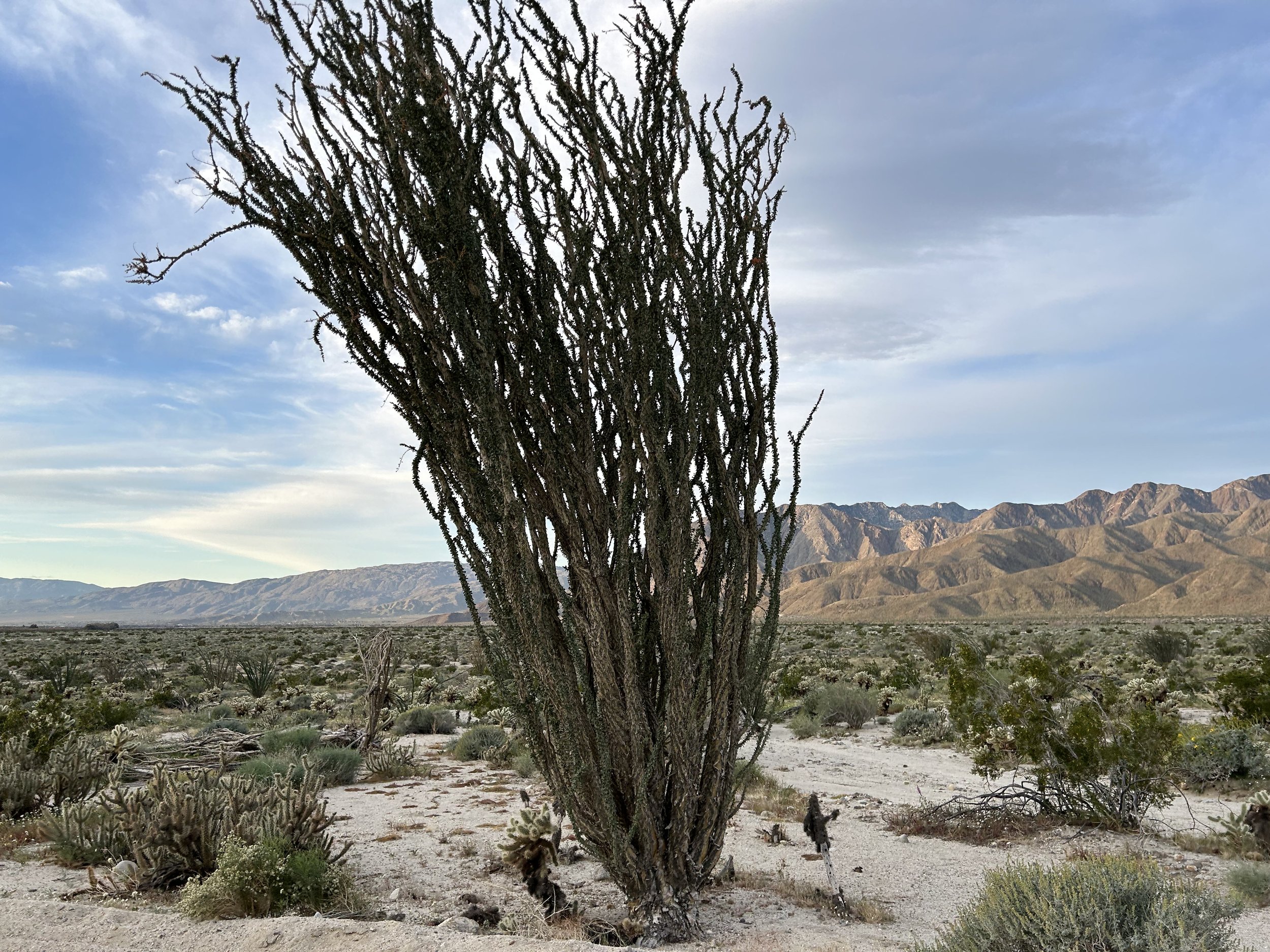
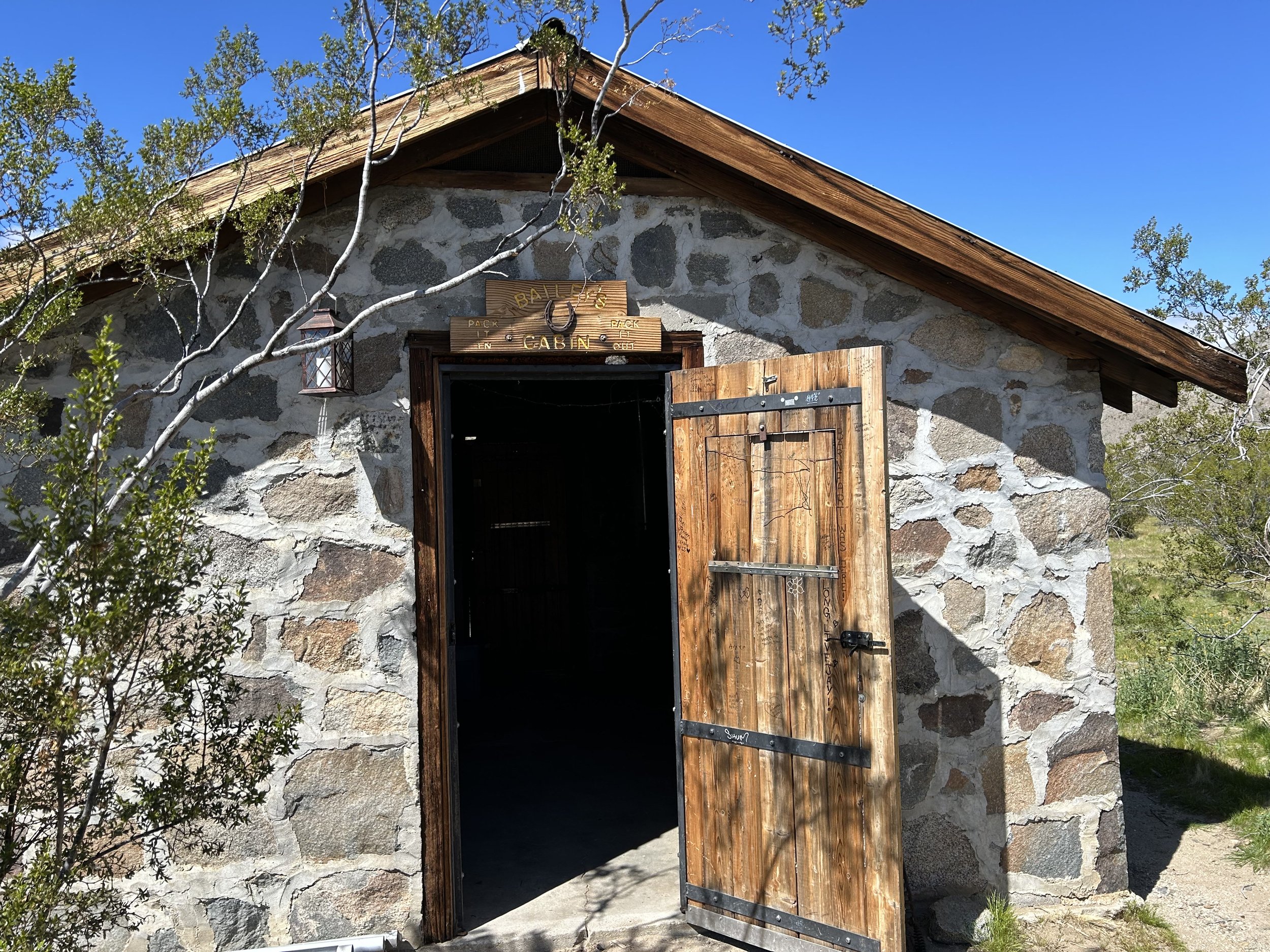
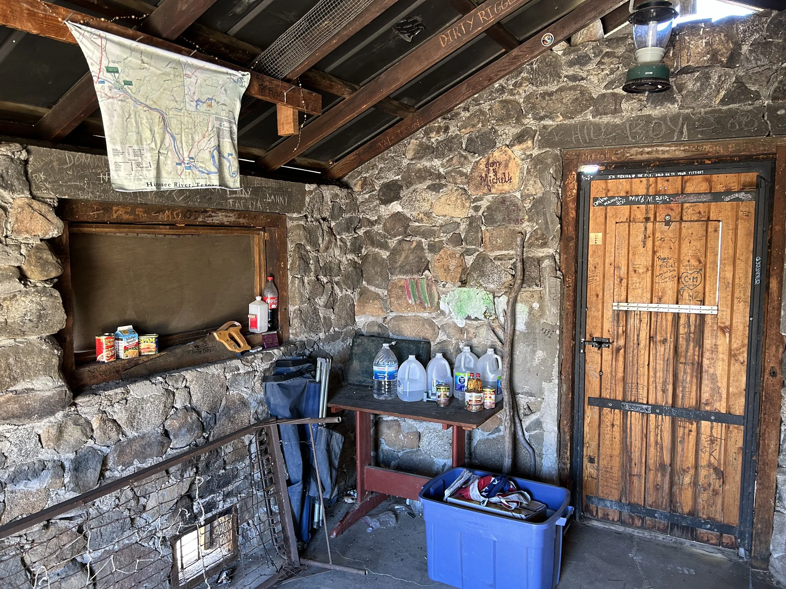
The Upper Willows appear as a line of massive palms blowing in the wind. Their fronds bend backwards towards us betraying the headwind we march into. My GPS watch beeps loudly informing me that we've missed our turn. We head a few hundred feet back towards the palms and see an easier, sandier side-wash to push our bikes up. But then the wash cuts up a bank and doubletrack appears - the first clear sign of an official route in hours. We can pedal and do-so down through crowded mesquite where a turn and sign marks Bailey's Cabin. I'm excited to see this place as a point of interest on the route. Janna isn't interested though and sticks with the bikes while I walk over to it. Two Jeeps are parked nearby, and there are two guys having a lunch outside the historic cabin. They ask where I've biked from - I tell them and their eyes widen unsure of a cyclist coming up Coyote Canyon from Borrego Springs. I head into the cabin. It's clean and stocked with water and canned food left for others by passing users. The Jeepers want to know if we need anything, but I decline already feeling like my bike is heavier than I want it for the elevation gain and speed we need to make.
We leave Bailey's Cabin on lightly sanded doubletrack that swerves inland from Coyote Creek across Fig Tree Valley. The Stagecoach 400 weaves amid mesquite, and it's suddenly hot. So hot that I'm sweating hard and shedding all layers. The wind is cut amid this land-cove and the clouds are replaced by entirely blue skies. I pedal on to catch up to Janna and sink back into sand so thick I pedal and stop. It's back to a mixture of hike-a-bike and riding over the next few miles. The doubletrack heads back out towards Coyote Creek once more, paralleling it above on its western banks before crossing down into it. We're back in the soup of stone and sand carefully picking our way. Both us are sweating - we down a salt pill each. Then back to pushing our bikes. Janna and I reach the northern end of Coyote Canyon where it bifurcates into a series of smaller canyons. The route stretches across a split of dry desert washes and then immediately shoots up the adjoining mountainside. It looks shockingly steep - erosion and deposition have done their work rotting the road into major ruts and boulder beds in parts. This is it - the climb out of Anza-Borrego Desert and into Terwilliger and then Anza Valleys.
There is nothing to do but jump off the bike and start pushing uphill. Janna goes first so I can snap a photo of her on the climb to show how inclined it is. We take the first switchback slowly. Each step has to be carefully planted because the dirt tread beneath our feet crumbles and slips. I hear a distant noise. I turn around and see the two Jeepers from before beginning the climb below us. They overland crawl absolutely slowly up the decaying road behind/below us. Janna and I turn and keep pushing to keep ahead of the duo's vehicles. I hit a stride of consistency rising further from the desert floor. Switchbacks turn steeply. I follow in kind. It's one thousand slow feet of pushing elevation gain. Telltale sings of biome change bloom around us in the form of less cacti and more grass. We round one last bend and start rolling up and down pitched hills tumbling towards Terwilliger Valley. The rocks are geologically different here. I can see distant cloud-studded peaks. The temperature has dropped rapidly with the wind kicking just as hard as it has been. We throw on wind jackets to coast down and then climb back up a series of tumbling hills where sand it grittier and firmer - more soil and rock-like. A single ranch appears across a flat as we cross the border out of Anza-Borrego Desert State Park. I turn back to glance at where we've come. It feels unreal - all difficult and unfathomably completed. It feels damn good.


Janna and I push our bikes up one last large hill before coasting down dirt that transitions to pavement. We turn off Coyote Canyon onto paved and busy Terwilliger Road. We're both grateful to have some pavement under our tires now. We can make miles and time. Except, now we've turned north into a graying mass of winter clouds, distant but coming. I'm exhausted and looking forward to Sunrise Market on the outskirts of Anza. The wind is fiercely against our favor again. But the drive for a food resupply keeps my legs moving. We turn into the RV park host to Sunrise Market at about 3 pm and 25 miles into the day. It's taken us 9-10 hours to cover 25 miles since this morning and we look exactly like how difficult those miles have been. I'm bonked and shaking walking into the store where the owner excitedly greats us as Stagecoach 400 riders. She offers us homecooked and warm samosas. I buy ice cream despite the mid-40 degree temperatures outside. The cashier tells us we can camp here tonight if want. It's absolutely tempting, but we have two nights reserved starting tonight at Idyllwild hotel. She also tells us that a lot of riders get to this part of the route and exclaim their disbelief that it took them 12 hours to do the section we did.
I can believe it. 9-10 hours for us is not looking too bad right now.
I head outside to eat at a picnic table round back. Samosas, a candy bar, chips, ice cream, and canned refried bean dip. I eat all the calories while shivering from the dropping temperatures. Janna comes back and says we need to get moving to prevent arriving too late in the dark. I agree while changing into pants and my warmer layers. Every pedal stroke forward feels like a change in elevation, ecosystem, and climate compared to where we've spent the last few days. We continue straight on the pavement uphill before joining a dirt set of backroads through an exurb of rural properties. Dogs come running to fence lines to bark and protest. The two of us reach the junction where the Stagecoach 400 heads right to take some singletrack that climbs up-and-down while essentially paralleling the road. This road (Highway 371) is the same road we took three years ago to ride the Sierra Cascades. Some quick math reveals sundown only a few hours away with still nearly 3000 feet of gain ahead of us. The choice is easy - we skip the singletrack to ride the shoulder of the highway into the San Bernadino National Forest. I feel some regret for skipping the official dirt route. Those feelings evaporate as our easterly direction cuts the wind and runs smooth on tarmac. I watch the route on our rights down in a valley and realize we would have added an hour or two more to our time if we had taken it - even with our steady uphill climbing on the pavement.
The sun is caking the landscape in golden hour. But the light is getting cut up by an assortment of clouds brewing stormily over the San Jacintos. Janna and I hit the intersection with the Pines to Palms Highway (HWY 74) and swing a left. This is the same at the Sierra Cascades. We've done this route before and ride with experienced expectation. The clouds and light are moving fast around us. The day is slipping and evening approaches. Large Jeffrey and ponderosa pines rise up in the sub-montane forests near Thomas Mountain. Large, spilling meadows gather at the footsteps of the forest and lay open a scene of wintery might. A smear of gray and blue low-slung winter cumulus is completing covering the mountains from view. It's a winter storm up on Idyllwild - right where we're riding at the edge of sunset. We pause under a series of pine trees a mile or two short of Lake Hemet to put on our warmest gear. It's 6 pm and we've been riding for 13 hours. We have more to go.
I pull out an emergency bag of Sourpatch Kids in watermelon flavor - my favorite motivation food in the backcountry. The two of eat as the winter storm thickens, the wind picking up making temperatures drop into the 30s. It's crux moments like this that get encased deep in my memory. I smell the pine around me and the sweet/sour taste of the candy.
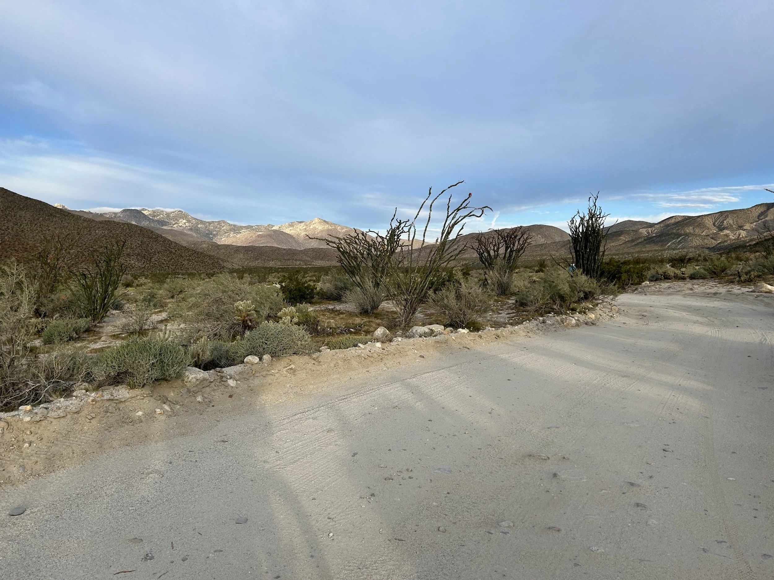
"We're getting up there no matter what tonight," I say. "The clouds are low and there is no shoulder on that road from what I remember. We're going to ride single file and we can always pull over if the conditions get too bad in the storming dark." We put on all of our warmest clothing, turn on our lights, and don our safety reflective vests. We pedal forward into dusk. Quick is the wind in hitting us. I drop into my biggest cog and move my legs rhythmically past closed Lake Hemet as we start climbing. Several cars pass us in the shade of night, and we pull over at a pullout where I look out at the mountains covered by a sling of cloud. I snap a photo and then catch up to Janna. We climb and climb until we reach Mountain Center. It's absolutely dark now - well into the night. We have 4.5 miles now and 1000 feet of gain to the top. It's the last big push. But the night has grown heavier with wintery fog descending. This is some of the worst fog I have ever been in in my life. Dense, consistent, and short for depth of vision. Janna and I agree that the next miles to the top must be taken with care for our safety. There is no shoulder along Highway 243 from here to the top, and there are plenty of cars coming and going. We agree that I will yell "Car!" anytime I see one coming up behind us. Despite our lights and vests, the night and fog make it almost impossible for vehicles to see us until they are nearly on top of us. When I yell "car," we'll both immediately get off our bikes and stand off the highway side. It's a workable solution for sus conditions.
And that's how the next hour passes as we climb to the top. Repeated jumping off the bike into roadside vegetation and rock piles, leaning our bikes away from the road in the soup fog dark. Janna and I make our way staccato-fashion to the top. Just as we reach the sign for Idyllwild city limits, the fog layer rolls back and we are amid the mountain peaks at over 5280 feet. I look back in the moonlight. I can clearly see an ocean of wintery fog below us - the stars are insanely clear and the wind has died way up here on high. I flip out my phone while riding to desperately locate a restaurant open mid-week in March at past 8 pm. There is one: Lumber Mill Bar & Grill. It's downtown and has burgers - it's what I want.
The temperatures have fallen to near freezing. But I'm warm, all filled with adrenaline and drive for dinner. We roll through downtown and immediately make for Lumber Mill. We pull up to the restaurant and see it's packed with patrons. We park our bikes to head inside where an immediate eruption of cheers greets us. A bunch of Pacific Crest Trail hikers staying in town tonight saw us roll up with great curiosity and anticipation. Realizing we were fellow human-powered backcountry adventurers, they excitedly asked us where we had ridden and how far. I can say there was absolutely nothing, and I mean absolutely nothing, better than the feeling of victory after challenge that came with that dinner when I was served a massive burger and hot food amid cheers of those PCTers about us bikepacking up to Idyllwild. Janna and I ate and talked with them until nearly 10 pm. We then rode over to Idyllwild Inn to grab our room, take hot showers, and fall to sleep with the buzz of accomplishment, pride, and the appreciation of all the beauty we had seen that day.