Tres Rios Loop - Day 1 - Saguaros, Junipers, and a Wander down the Santa Maria River
Date: January 12, 2024
36.8 Miles
4,134 Feet of Gain
Signal Road outside Wikieup, AZ to the Santa Maria River
January is always the middle of winter here on the South Rim. And the craving for desert warmth and escape always hits true. When Janna and I were looking ahead to the MLK, Jr. holiday weekend, we decided to travel with Dan and Kate, who were scheduled for furlough and were going to be down in Arizona from Glacier NP at that time. The four of us wanted to catch up, and we felt a bikepacking trip through the desert deserved merit for an adventure all together. At first, we were looking at creating a route through Gold Butte NM, but we all felt a closer, warmer, and shorter route would be preferable since none of us had ridden much due to winter. At the beginning of December, Kurt Refsnider published his Tres Rios Loop.
Tres Rios is a southwestern desert bikepacking route located in west-central Arizona. It does a big circumference of the Arrastra Mountain Wilderness and weaves by the Tres Alamos, Rawhide Mountains, and Upper Burro Creek Wildernesses. It's name derives from the three main rivers it crosses: the Santa Maria, Big Sandy, and Bill Williams. Subsequently, it wraps around Alamo Lake where these rivers end at reservoir. And most excitingly, it travels through a unique region where three ecosystems merge: the Colorado Plateau, the Sonoran Desert, and the Mojave Desert. As a result, there are multiple instances on the route where juniper trees, saguaro cacti, and Joshua trees grow side-by-side - a rare thing to see!
I started pouring over the RWGPS route leading up to the trip. Although Kurt called for starting at the very southeastern portion of the route, I decided to have us park/start on BLM land up at the very northern part a mile west down Signal Road right off Highway 93. The advantages to us were a resupply mid-trip at Alamo Lake/Wayside (as opposed to riding by these Day 1) and less driving for us coming from the Grand Canyon. The two days prior to the start of the trip, a massive snowstorm came dropping loads of winter precipitation across the state. Snow levels fell to around 3500 feet (which corresponded to the highest touches of the route). Even lower portions in the desert received solid rain. On top of that, a plummet of temperatures meant state-wide frigid temperatures. The four of us woke up at 5 am on Friday and caravanned to our starting point (with a pause in Williams for coffee).
By the time we arrived, the outside temperatures were 28 degrees F - a chilly start for a desert ride. We put our bikes together and just sat absorbing the sun. And then we pushed off just before 10 am. Signal Road turned out to be the best of hero dirt. It was wide, well-graded, and smooth as silk - one of the rare dirt roads in Arizona where I would consider riding a skinny-tired gravel bike (much of the rest of the trip was on rutted dirt roads and copious sand - so bring that mountain bike!). We had a lot of uphill planned for day 1 which didn't disappoint. We passed by Elephant Mountain on a beautiful climb with some hike-a-bike for us with winter-fatigued legs. Along a side-canyon, juniper trees fecund with pale-blue seed popped up along with crown-of-thorn plants. And then saguaros - growing in nurse trees of juniper! Freaking awesome. Dan's a plant biologist and kept stopping to talk about the diversity of plant life and the unusual spread of species growing together.
The route descended a bit before wrapping through more rocklands with saguaros and junipers but now yuccas with old-pale blooms and ocotillos galore. Red Knob appeared ahead and we stopped to take it in from a distant vantage. Then it was some climbing up to the intersection of Sycamore Camp and Burro Creek Crossing roads. We laid the bike downs and listened to a large herd of wild burros down a drainage next to us calling and screaming. There were so many wild burros along the route - though non-native, we found them super cool. The four of us ate lunch and soaked up the sun. Then began a large descent down to Burro Creek through the ecologically sensitive area of Clay Hills.
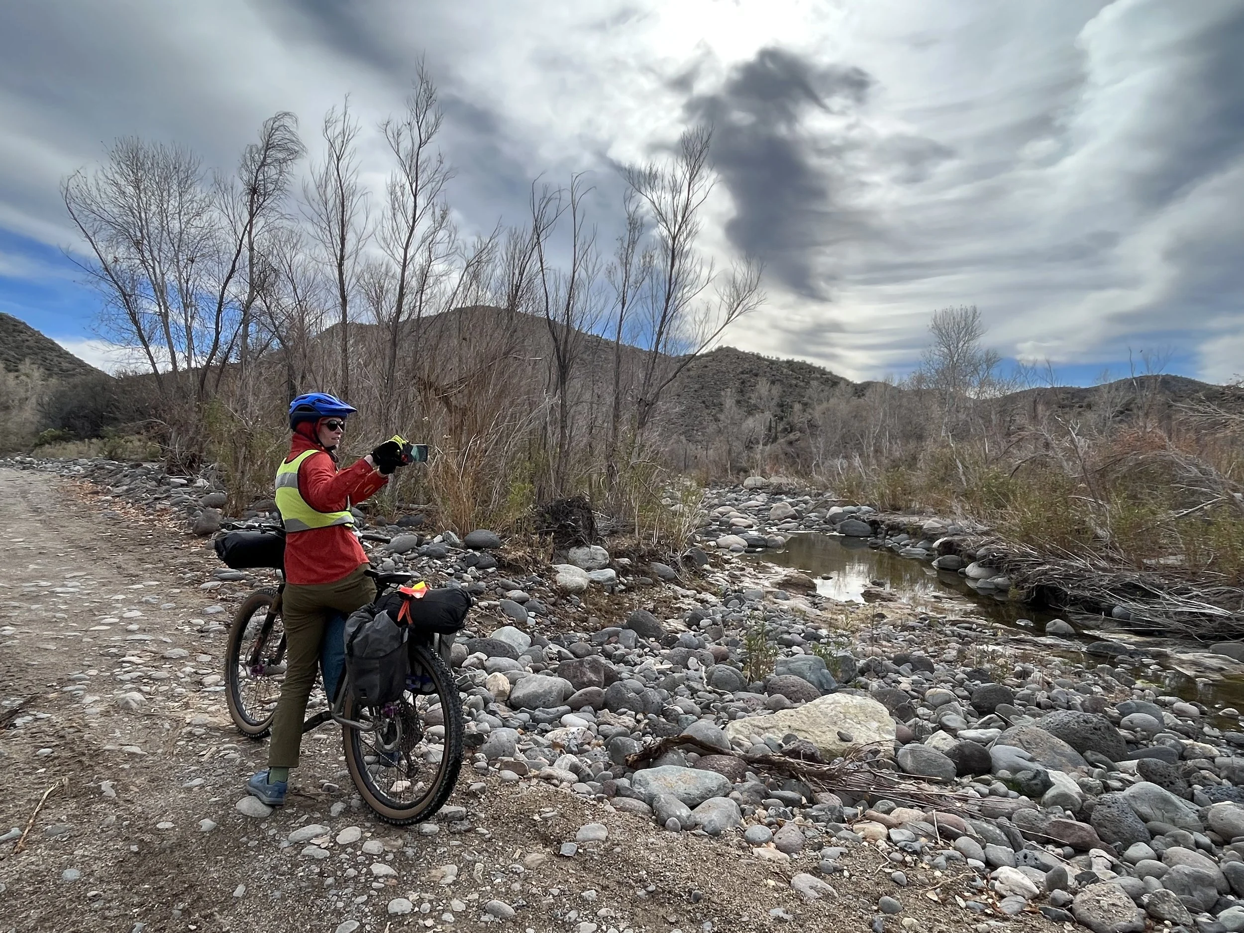
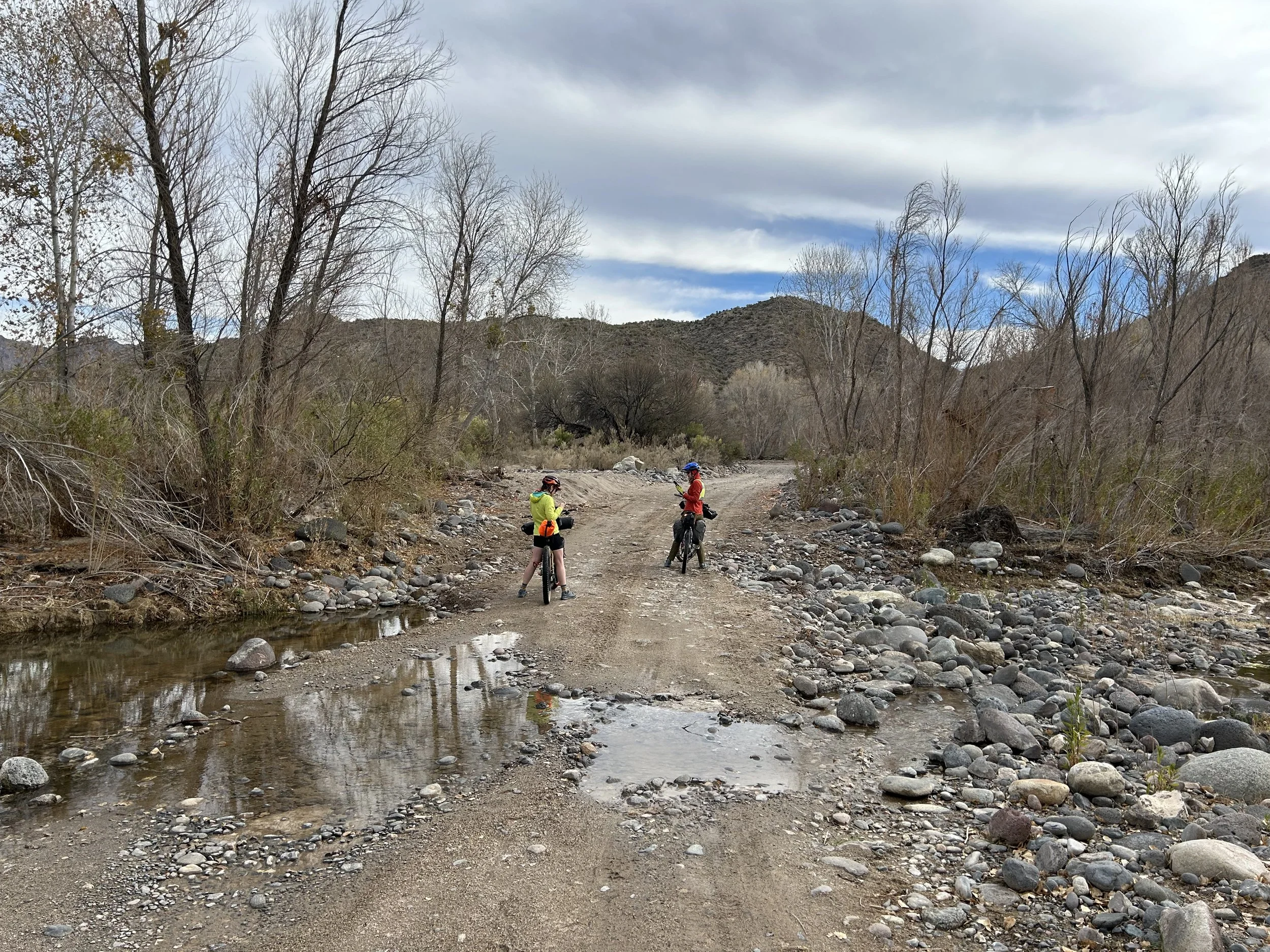
The winter storm had produced a nice flow and set of pools in Burro Creek. It was well-framed under barren winter-armed sycamores and cottonwoods. We continued out of the creek basin and up the road along Suicide Wash through a canyon. The sand on this section was serious. It quickly turned deep and fine. We all were sporting 2.6 - 2.8 inch tires, so we dropped to granny gears and started a slow uphill through the sand. Kate called out that there were very large, well-defined mountain lion tracks that were fresh in the sand. After looking at them (so cool!), we looked around knowing it was probably nearby watching us. Frequent burro tracks also dotted the sandy riffles.
The four of us began hike-a-biking through the deepest sand as pedaling became inefficient to the point that we were falling over. Suddenly, we popped out among a jumble of interesting sandstone rock pinnacles where we turned down a sandy and wide road cutting through a dense stand of junipers and yuccas. The temperature was beginning to drop, cutting just above freezing. The dirt road merged with paved 97 that then led us to Highway 93. We all put on our safety vests and turned on our back lights as it was late afternoon in winter and some high cloud cover was gently gathering in the sky reducing visibility. Luckily, the ride on the shoulder of Highway 93 was pretty fast. It was several miles of almost entirely fast downhill on a wide shoulder, despite heavy and fast traffic. What caught us off-guard was the next portion of the route.
Kate and I were staring at our GPS devices in anticipation of the turn that would take us off the highway, across a short stint on private land through a wash, and onto a dirt road on state land where we could legally camp. Except, we arrived at our turn and didn't see a dirt road. Instead, we zoomed in on the GPX track to realize that we were gong to need to dismount our bikes and do a bushwhack scramble down a hillside to avoid the private land. A bit surprised, we all helped each other life our heavy rigs over the railing on the side of the highway. Then, Kate and I went scout-scrambling down the thornscrub-choked hillside for the best way to get to the Santa Maria River wash. About 30 minutes later, with sunset fast approaching, we scrambled back up to the highway and led the group tenuously down the steep hillside through creosote, cholla, and brush to a level spot. Here, a large barbed wire fence separated us from the sandy river bottom. There was a significant lower gap at the barbed wire fence. We split into two teams: one team held on to the bottom of the fence to lift it as high as possible and the other team pushed/pulled the heavy bikepacking rigs under the fence.
Finally, we were on the floodplain of the Santa Maria River. We pedaled along an old vegetation-chocked doubletrack that decayed into brush where we got off and pushed our bikes through jumbles of mesquite, looking for the best way to the main sand-river-channel visible ahead. We made our way through another fence and started to push our bikes through riparian woodlands. It was hotly past sunset at this point with temperatures below freezing. The impetus was on to get through this hike-a-bike down the river channel to public land to setup camp. The sky became a spectacular splay of winter-desert colors. It was absolutely gorgeous. We turned on bike lights to lead the way as we wandered and wove down river-stone and through thickets of cottonwood brush. Due to the winter storm, the Santa Maria had a decent flow of water and some deep pools. At one point, we cliffed-out above a really deep/impassable hole of water where the river took a drop over boulders.
We worked our way arduously around it and realized we had to cross the water once more. A strong smell hit our noses and we turned to see the huge rotting carcass of a dead cow lying on the bank and in the flow of water. Dan made a joke about us all getting tapeworm parasites, so we made distance from the cow to get downstream farther.
As it was below freezing and already fast into darkness, we didn't want our shoes/socks to freeze by getting them wet at this hour. We all took off our socks and shoes and waded bikes across the river-stream. At some point, I stopped in the dark to check the "Private Land" layer on Gaia to confirm we were off private land. Luckily we were. It was past dark enough that no one wanted to bushwhack much further so we found a grassy embankment just above the river where we decided to setup camp. The temperature was really falling so we quickly setup camp, put on warm clothing, and set about making dinner in the night. I have a general backcountry rule never to camp near water and low to avoid cold spots and condensation. Tonight would encompass both of these. As soon as dinner was finished, we crawled into our tents, tired and ready for sleep.


